Benutzer:Kathe/Labor: Unterschied zwischen den Versionen
Zur Navigation springen
Zur Suche springen
Kathe (Diskussion | Beiträge) Keine Bearbeitungszusammenfassung |
Kathe (Diskussion | Beiträge) |
||
| (169 dazwischenliegende Versionen von 2 Benutzern werden nicht angezeigt) | |||
| Zeile 1: | Zeile 1: | ||
{{Shadowtalk|Das Labor ist so... leer. - Schade!|Dr. Marvin Mondo}} | {{Shadowtalk|Das Labor ist so... leer. - Schade!|Dr. Marvin Mondo}} | ||
__TOC__ | |||
==Produktbeschreibung== | |||
... more to come ... | |||
==Quellen-Infobox Zusatzmaterial== | |||
{{Zusatzmaterial | {{Zusatzmaterial | ||
|TYP=Kurzabenteuer | |TYP=Kurzabenteuer | ||
| Zeile 9: | Zeile 14: | ||
|DATUM=2003 | |DATUM=2003 | ||
}} | }} | ||
<br style="clear:both"/> | |||
==Karten f. Locations== | |||
{{Location | {{Location | ||
|CLEAR=right | |||
|STAND=2064 | |||
|QUELLE= | |||
|NAME_OVR=Fachhochschule München | |||
|ALTERNATIV= | |||
|BESCHREIBUNG={{nlt}}Fachhochschule | |||
|LAGE= | |||
|KOORD_DISPLAY=1 | |||
|KOORD_LAENGE=11/33/13.1/O | |||
|KOORD_BREITE=48/9/18.1/N | |||
|POSITIONSKARTE=ADL | |||
}} | |||
{{Location | |||
|CLEAR=right | |||
|STAND=2062 | |||
|QUELLE= | |||
|NAME_OVR=Kartoffelhaus | |||
|ALTERNATIV= | |||
|BESCHREIBUNG=Restaurant | |||
|LAGE=etwas hinter dem Spremberger Turm, Innenstadt von Cottbus, Land Brandenburg, ADL | |||
|KOORD_DISPLAY=1 | |||
|KOORD_LAENGE=14/20/0.16/O | |||
|KOORD_BREITE=51/45/27.67/N | |||
|POSITIONSKARTE=ADL | |||
}} | |||
{{Location | |||
|CLEAR=right | |||
|STAND=2064 | |||
|QUELLE= | |||
|NAME_OVR=Ludwig-Maximilians-Universität München | |||
|ALTERNATIV=LMU München | |||
|BESCHREIBUNG={{nlt}}Universität | |||
|LAGE= | |||
|KOORD_DISPLAY=1 | |||
|KOORD_LAENGE=11/34/49/O | |||
|KOORD_BREITE=48/9/3/N | |||
|POSITIONSKARTE=ADL | |||
}} | |||
{{Location | |||
|CLEAR=right | |||
|STAND=2064 | |||
|QUELLE= | |||
|NAME_OVR=Freudenstrand | |||
|ALTERNATIV= | |||
|BESCHREIBUNG={{nlt}}(Swinger-)Club | |||
|LAGE=Markgrafenstraße 18, Friedrichshain-Kreuzberg, Berlin | |||
|KOORD_DISPLAY=1 | |||
|KOORD_LAENGE=13/22/36.965/O | |||
|KOORD_BREITE=52/30/58.252/N | |||
|POSITIONSKARTE=Berlin | |||
}} | |||
{{Location | |||
|CLEAR=right | |||
|STAND=2071 | |||
|QUELLE= | |||
|NAME_OVR=Universität Paderborn | |||
|ALTERNATIV= | |||
|BESCHREIBUNG={{nlt}}Universität | |||
|LAGE= | |||
|KOORD_DISPLAY=1 | |||
|KOORD_LAENGE=8/46/20/O | |||
|KOORD_BREITE=51/42/29/N | |||
|POSITIONSKARTE=ADL | |||
}} | |||
{{Location | |||
|CLEAR=right | |||
|STAND=2071 | |||
|QUELLE= | |||
|NAME_OVR=École Normale de Musique de Paris | |||
|ALTERNATIV= | |||
|BESCHREIBUNG={{nlt}}Musikhochschule | |||
|LAGE=114 bis, Boulevard Malesherbes, Innenstadt [[Paris]], [[Frankreich]] | |||
|KOORD_DISPLAY=1 | |||
|KOORD_LAENGE=2/18/33/O | |||
|KOORD_BREITE=48/53/2/N | |||
|POSITIONSKARTE=Frankreich | |||
}} | |||
{{Location | |||
|CLEAR=right | |||
|STAND=2064 | |||
|QUELLE= | |||
|NAME_OVR=Lloyd's of London | |||
|ALTERNATIV= | |||
|BESCHREIBUNG={{nlt}}Internationaler Versicherungsmarkt | |||
|LAGE=Lloyd's Building, London, England, UK | |||
|KOORD_DISPLAY=1 | |||
|KOORD_LAENGE=0/04/56.5/W | |||
|KOORD_BREITE=51/30/47/N | |||
|POSITIONSKARTE=Großbritannien | |||
|POSKARTE_OVERLAY=Overlay_Großbritannien_London.png | |||
}} | |||
{{Location | |||
|CLEAR=right | |||
|STAND=2082 | |||
|QUELLE= | |||
|NAME_OVR=Aalborg | |||
|ALTERNATIV=Ålborg, dtsch.: Aalburg (veraltet) | |||
|BESCHREIBUNG={{nlt}}Geisterstadt (nach toxischem Schlamm stinkende Ruinen) / Kriegszone beim [[Urban Brawl]] | |||
|LAGE=[[Dänemark]], [[Skandinavische Union]] | |||
|KOORD_DISPLAY=1 | |||
|KOORD_LAENGE=9/55/7/O | |||
|KOORD_BREITE=57/2/52/N | |||
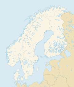
|POSITIONSKARTE=Skandinavien | |||
}} | |||
{{Location | |||
|CLEAR=right | |||
|STAND=2082 | |||
|QUELLE= | |||
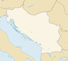
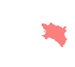
|NAME_OVR=Serbien | |||
|KOORD_DISPLAY=1 | |||
|KOORD_LAENGE=12/58/15/O | |||
|KOORD_BREITE=50/25/9/N | |||
|POSITIONSKARTE=Balkan-Konfliktzone | |||
|POSKARTE_OVERLAY=Overlay Balkan-Konfliktzone Serbien.png | |||
|NUR_OVERLAY=1 | |||
}} | |||
{{Location | |||
|CLEAR=right | |||
|STAND=2075 | |||
|QUELLE= | |||
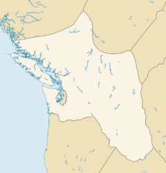
|NAME_OVR=Missoula-Forschungseinrichtung | |||
|KOORD_DISPLAY=1 | |||
|KOORD_LAENGE=114/0/0/W | |||
|KOORD_BREITE=46/50/0/N | |||
|BESITZER=Gaeatronics | |||
|SECURITY=Gaeatronics-Konzernsicherheit | |||
|POSITIONSKARTE=Salish-Shidhe | |||
}} | |||
{{Location | |||
|CLEAR=right | |||
|STAND=2080 | |||
|QUELLE= | |||
|NAME_OVR=Grande | |||
|KOORD_DISPLAY=1 | |||
|KOORD_LAENGE=10/23/21/O | |||
|KOORD_BREITE=53/34/53/N | |||
|POSITIONSKARTE=ADL | |||
}} | |||
{{Location | |||
|CLEAR=right | |||
|STAND=2080 | |||
|QUELLE= | |||
|NAME_OVR=Ernst-Moritz-Arndt-Universität Greifswald | |||
|KOORD_DISPLAY=1 | |||
|KOORD_LAENGE=13/22/28/O | |||
|KOORD_BREITE=54/5/40/N | |||
|POSITIONSKARTE=ADL | |||
|POSKARTE_OVERLAY= | |||
|NUR_OVERLAY= | |||
}} | |||
{{Location | |||
|CLEAR=right | |||
|STAND=2082 | |||
|QUELLE= | |||
|NAME_OVR=Kroatien | |||
|KOORD_DISPLAY=1 | |||
|KOORD_LAENGE=12/58/15/O | |||
|KOORD_BREITE=50/25/9/N | |||
|POSITIONSKARTE=Balkan-Konfliktzone | |||
|POSKARTE_OVERLAY=Overlay Balkan-Konfliktzone Kroatien.png | |||
|NUR_OVERLAY=1 | |||
}} | |||
{{Location | |||
|CLEAR=right | |||
|STAND=2082 | |||
|QUELLE= | |||
|NAME_OVR=Jodel-Babuschka | |||
|BESCHREIBUNG={{nlt}}Bar mit Livemusik (Apés-Ski- / Absturzkneipe) | |||
|LAGE=Tiefparterre / Keller, zentral an der Hauptstraße, [[Oberwiesenthal]], [[Erzgebirge]], [[Freistaat Sachsen]], [[ADL]] | |||
|KOORD_DISPLAY=1 | |||
|KOORD_LAENGE=12/58/15/O | |||
|KOORD_BREITE=50/25/9/N | |||
|BESITZER={{nlt}}Investoren (nominell: [[Baba Mama]],<br/>eigentl. [[Sascha Mupfe]] & [[Elise Koch]]) | |||
|SICHERHEIT={{nlt}}zwei Türsteher, [[Elise Koch]] (Ex-Soldatin), städtische Sicherheitskräfte (wenn die Party zu sehr eskaliert) | |||
|POSITIONSKARTE=ADL | |||
}} | |||
{{Location | |||
|CLEAR=right | |||
|STAND=2081 | |||
|QUELLE= | |||
|NAME_OVR=Gotland | |||
|ALTERNATIV= | |||
|BESCHREIBUNG=große Ostseeinsel | |||
|LAGE={{nlt}}[[Ostsee]] vor der [[Schweden|schwedischen]] Küste, [[SkandU]] | |||
|KOORD_DISPLAY=1 | |||
|KOORD_LAENGE=18/30/34/O | |||
|KOORD_BREITE=57/29/57/N | |||
|KOORD_KBS=1 | |||
|KOORD_ZGM=14 | |||
|BESITZER=[[Schweden]] | |||
|SICHERHEIT= | |||
|POSITIONSKARTE=Skandinavien | |||
}} | |||
{{Location | |||
|CLEAR=right | |||
|STAND=2081 | |||
|NAME_OVR=Livländische Ordensburg | |||
|ALTERNATIV={{nlt}}Burg des Deutschen Ordens, Schloss des Livländischen Ordens, ehem. Burg "Winda" | |||
|ERBAUT=1290 | |||
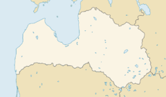
|LAGE=[[Ventspils]], [[Lettland]] | |||
|BESCHREIBUNG={{nlt}}historische Ordensburg, beherbergt während des [[Eurobrawl 2081]] [[Erika]]-Medienzentrum | |||
|KOORD_DISPLAY=1 | |||
|KOORD_LAENGE=21/34/24/O | |||
|KOORD_BREITE=57/23/26/N | |||
|KOORD_KBS=1 | |||
|KOORD_ZGM=14 | |||
|POSITIONSKARTE=Lettland | |||
|POS_LABEL= | |||
|POSKARTE_OVERLAY= | |||
}} | |||
{{Location | |||
|CLEAR=right | |||
|STAND=2081 | |||
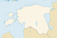
|NAME_OVR=Saaremaa | |||
|KOORD_DISPLAY=1 | |||
|KOORD_LAENGE=22/32/0/O | |||
|KOORD_BREITE=58/25/0/N | |||
|KOORD_KBS=1 | |||
|KOORD_ZGM=14 | |||
|POSITIONSKARTE=Estland | |||
|POS_LABEL=Saaremaa | |||
|POSKARTE_OVERLAY= | |||
}} | |||
{{Location | |||
|CLEAR=right | |||
|NAME_OVR=Roche Blanche de la mer | |||
|STAND=2071 | |||
|QUELLE= | |||
|LOGO= | |||
|COPYRIGHT= | |||
|ALIAS= | |||
|ART= | |||
|BESCHREIBUNG={{nlt}}Freie Stadt auf gleichnamiger Insel | |||
|TYP= | |||
|ERBAUT={{nlt}}nach dem Auftauchen der Insel und ihrer Verpachtung an die Eigentümergemeinschaft [[2039]] | |||
|GRÜNDUNG= | |||
|LAGE={{nlt}}gleichnamige Insel, [[Normandie]], [[Frankreich]] | |||
|KOORD_DISPLAY=1 | |||
|KOORD_LAENGE=2/12/57/W | |||
|KOORD_BREITE=48/52/57/N | |||
|KOORD_KBS=1 | |||
|KOORD_ZGM=12 | |||
|FLÄCHE= 108 km² | |||
|SICHERHEIT= Securité SA | |||
|BESITZER=Frankreich / Eigentümergemeinschaft (in Erbpacht) | |||
|LTG= | |||
|ZERSTÖRT= | |||
|ZERSTÖRER= | |||
|BILD= | |||
|COPYRIGHT2= | |||
|POSITIONSKARTE=Frankreich | |||
}} | |||
{{Location | |||
|CLEAR=right | |||
|NAME_OVR=Haus Dallmayr | |||
|STAND=[[2080]] | |||
|QUELLE= | |||
|LOGO= | |||
|COPYRIGHT= | |||
|ALIAS= | |||
|ART= | |||
|BESCHREIBUNG=Feinkostgeschäft / Brasserie / Restaurant / Stammsitz | |||
|TYP= | |||
|ERBAUT= | |||
|GRÜNDUNG= | |||
|LAGE={{nlt}}Dienerstraße 14–15, [[München]], [[Freistaat Bayern]], [[ADL]] | |||
|KOORD_DISPLAY=1 | |||
|KOORD_LAENGE=11/34/38.1/O | |||
|KOORD_BREITE=48/8/17.8/N | |||
|KOORD_KBS=1 | |||
|KOORD_ZGM=13 | |||
|BESITZER=[[Dallmayr]] | |||
|SICHERHEIT=[[Schwarze Sheriffs]] | |||
|LTG= | |||
|ZERSTÖRT= | |||
|ZERSTÖRER= | |||
|BILD= | |||
|COPYRIGHT2= | |||
|POSITIONSKARTE=ADL | |||
|POSKARTE_OVERLAY= | |||
|COPYRIGHT3= | |||
}} | |||
{{Location | |||
|CLEAR=right | |||
|NAME_OVR=Oberlandesgericht Düsseldorf | |||
|STAND=[[2083]] | |||
|QUELLE= | |||
|LOGO= | |||
|COPYRIGHT= | |||
|ALIAS= | |||
|ART= | |||
|BESCHREIBUNG=Gerichtsgebäude | |||
|TYP= | |||
|ERBAUT= | |||
|GRÜNDUNG= | |||
|LAGE={{nlt}}Innenstadt [[Düsseldorf]]s, [[Rhein-Ruhr-Megaplex]], [[Nordrhein-Ruhr]], [[ADL]] | |||
|KOORD_DISPLAY=1 | |||
|KOORD_LAENGE=6/46/19.9/O | |||
|KOORD_BREITE=51/14/20.1/N | |||
|KOORD_KBS=1 | |||
|KOORD_ZGM=13 | |||
|BESITZER=Land [[Nordrhein-Ruhr]] | |||
|SICHERHEIT=[[Ruhrpolizei]] | |||
|LTG= | |||
|ZERSTÖRT= | |||
|ZERSTÖRER= | |||
|BILD= | |||
|COPYRIGHT2= | |||
|POSITIONSKARTE=ADL | |||
|POSKARTE_OVERLAY=Overlay ADL Rhein-Ruhr.png | |||
|COPYRIGHT3= | |||
}} | |||
{{Location | |||
|CLEAR=right | |||
|NAME_OVR=Café Dommayer | |||
|BESCHREIBUNG={{nlt}}Wiener Café-Haus | |||
|KOORD_DISPLAY=1 | |||
|KOORD_LAENGE=16/17/54.4/O | |||
|KOORD_BREITE=48/11/12.3/N | |||
|KOORD_KBS=1 | |||
|KOORD_ZGM=13 | |||
|POSITIONSKARTE=Wien | |||
|POS_LABEL=Café Dommayer | |||
}} | |||
{{Location | |||
|CLEAR=right | |||
|STAND=2050er/60er | |||
|QUELLE= | |||
|LOGO= | |||
|COPYRIGHT= | |||
|NAME_OVR=Château du Haut-Kœnigsbourg | |||
|ALTERNATIV={{nlt}}dtsch. ''Hohkönigsburg'' , engl. ''Haut-Kœnigsbourg Castle'' | |||
|BESCHREIBUNG=Schloss (Familiensitz) | |||
|LAGE={{nlt}}gut 10 km westlich von Sélestat (Schlettstadt), im [[Elsass]], [[Frankreich]] | |||
|KOORD_DISPLAY=1 | |||
|KOORD_LAENGE=7/20/39/O | |||
|KOORD_BREITE=48/14/58/N | |||
|KOORD_KBS=1 | |||
|KOORD_ZGM=13 | |||
|KOORD={{Koord|48|14|58|N|7|20|39|O|1|13}} | |||
|BESITZER=[[Haus Kœnigsbourg|Familie Kœnigsbourg]] | |||
|LTG= | |||
|POSITIONSKARTE=Frankreich | |||
|POS_LABEL= | |||
}} | |||
{{Location | |||
|CLEAR=right | |||
|NAME_OVR=Prison de Champ-Dollon | |||
|KOORD_DISPLAY=1 | |||
|KOORD_LAENGE=6/13/27.14/O | |||
|KOORD_BREITE=46/12/54.38/N | |||
|KOORD_KBS=1 | |||
|KOORD_ZGM=13 | |||
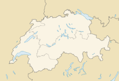
|POSITIONSKARTE=Schweiz | |||
|POS_LABEL=Champ-Dollon | |||
}} | |||
{{Location | |||
|CLEAR=right | |||
|NAME_OVR=Homburg-Saar | |||
|BESCHREIBUNG={{nlt}}bis zum Bombardement 2058: Geisterstadt / Ruinenstadt<br/>seither: nahezu vegetationslose Ödnis | |||
|KOORD_DISPLAY=1 | |||
|KOORD_LAENGE=7/20/0/O | |||
|KOORD_BREITE=49/19/0/N | |||
|KOORD_KBS=1 | |||
|KOORD_ZGM=13 | |||
|POSITIONSKARTE=SOX | |||
|POS_LABEL=Homburg-Saar | |||
}} | |||
{{Location | |||
|CLEAR=right | |||
|NAME_OVR=Hängende Kirche | |||
|BESCHREIBUNG={{nlt}}Koptische Kirche | |||
|KOORD_DISPLAY=1 | |||
|KOORD_LAENGE=31/13/48.29/O | |||
|KOORD_BREITE=30/0/19.4/N | |||
|KOORD_KBS=1 | |||
|KOORD_ZGM=13 | |||
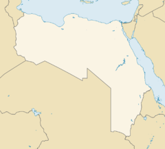
|POSITIONSKARTE=Ägypten | |||
|POS_LABEL=Hängende Kirche | |||
}} | |||
{{Location | |||
|CLEAR=right | |||
|NAME_OVR=Universität Venedig | |||
|BESCHREIBUNG={{nlt}}Uni | |||
|KOORD_DISPLAY=1 | |||
|KOORD_LAENGE=12/19/35.76/O | |||
|KOORD_BREITE=45/26/4.07/N | |||
|KOORD_KBS=1 | |||
|KOORD_ZGM=13 | |||
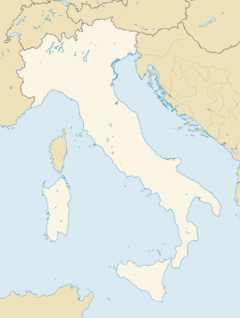
|POSITIONSKARTE=Italien | |||
}} | |||
{{Location | |||
|CLEAR=right | |||
|STAND=2059 | |||
|NAME_OVR=Tortola | |||
|BESCHREIBUNG={{nlt}}Insel (Altersruhesitz) | |||
|KOORD_DISPLAY=1 | |||
|KOORD_LAENGE=64/38/0/W | |||
|KOORD_BREITE=18/26/0/N | |||
|KOORD_KBS=1 | |||
|KOORD_ZGM=13 | |||
|POSITIONSKARTE=Karibische Liga | |||
|POS_LABEL=Tortola | |||
}} | |||
{{Location | |||
|CLEAR=right | |||
|STAND=2059 | |||
|NAME_OVR=St. Barthélémy | |||
|BESCHREIBUNG={{nlt}}Insel (Jetset-/Party-Location) | |||
|KOORD_DISPLAY=1 | |||
|KOORD_LAENGE=62/49/39.42/W | |||
|KOORD_BREITE=17/53/43.43/N | |||
|KOORD_KBS=1 | |||
|KOORD_ZGM=13 | |||
|POSITIONSKARTE= | |||
|POSITIONSKARTE=Karibische Liga | |||
|POS_LABEL=St. Barts | |||
}} | |||
{{Location | |||
|CLEAR=right | |||
|NAME_OVR=Ibiza<br/><small>(katalan. Eivissa)</small> | |||
|STAND=2073 | |||
|LAGE={{nlt}}vor der Ostküste Spaniens, Ballearen, Mittelmeer | |||
|BESCHREIBUNG={{nlt}}Insel (Touristen-Insel / Party Location) | |||
|KOORD_DISPLAY=1 | |||
|KOORD_LAENGE=1/23/34/O | |||
|KOORD_BREITE=38/56/55/N | |||
|KOORD_KBS=1 | |||
|KOORD_ZGM=13 | |||
|POSITIONSKARTE=Spanien | |||
|POS_LABEL=Ibiza | |||
}} | |||
{{Location | |||
|CLEAR=right | |||
|STAND=2073 | |STAND=2073 | ||
|LAGE={{nlt}}irgendwo im Nirgendwo | |LAGE={{nlt}}irgendwo im Nirgendwo, tief in der Wüste des PCC | ||
|BESCHREIBUNG={{nlt}} | |BESCHREIBUNG={{nlt}}Hooverdamm (nein: hier werden keine Hoover-Staubsauger hergestellt!) | ||
|KOORD_DISPLAY=1 | |||
|KOORD_LAENGE=114/44/16/W | |||
|KOORD_BREITE=36/0/56/N | |||
|KOORD_KBS=1 | |||
|KOORD_ZGM=13 | |||
|POSITIONSKARTE=Pueblo | |||
}} | |||
{{Location | |||
|CLEAR=right | |||
|STAND=? | |||
|NAME_OVR=Rächionoolfluchhaaf'n | |||
|KOORD_DISPLAY=1 | |||
|KOORD_LAENGE=92/13/11/W | |||
|KOORD_BREITE=38/49/5/N | |||
|KOORD_KBS=1 | |||
|KOORD_ZGM=16 | |||
|POSITIONSKARTE=UCAS | |||
|POS_LABEL=CRA | |||
}} | |||
{{Location | |||
|CLEAR=right | |||
|STAND=??? | |||
|BESCHREIBUNG=Dunguair Castle | |||
|LAGE={{nlt}}Halbinsel in der Bucht von [[Galway]], [[County Galway]], [[Connaught]], [[Tír na nÓg]] | |||
|KOORD_DISPLAY=1 | |||
|KOORD_LAENGE=8/55/34/W | |||
|KOORD_BREITE=53/8/32/N | |||
|KOORD_KBS=1 | |||
|KOORD_ZGM=13 | |||
|POSITIONSKARTE=Tír na nÓg | |||
|POS_LABEL=Dunguaire Castle | |||
|KARTE= | |||
}} | |||
{{Stadt | |||
|CLEAR=right | |||
|NAME_OVR=Marktkirche<br/>(Hannover) | |||
|STAND=2081 | |||
|KOORD_DISPLAY=1 | |||
|KOORD_LAENGE=9/44/6/O | |||
|KOORD_BREITE=52/22/18/N | |||
|KOORD_KBS=1 | |||
|KOORD_ZGM=13 | |||
|POSITIONSKARTE=ADL | |||
|POS_LABEL=Marktkirche | |||
}} | |||
{{Location | |||
|CLEAR=right | |||
|NAME_OVR=Psychiatrie Dortmund Aplerbeck | |||
|STAND=2080 | |||
|QUELLE= | |||
|BILD= | |||
|ALTERNATIV= | |||
|ALIAS= | |||
|BESCHREIBUNG=Psychiatrische Anstalt | |||
|LAGE=Dortmund Aplerbeck, [[Rhein-Ruhr-Megaplex]], [[Nordrhein-Ruhr]], [[ADL]] | |||
|KOORD_DISPLAY=1 | |||
|KOORD_LAENGE=7/32/50/O | |||
|KOORD_BREITE=51/30/22/N | |||
|KOORD_KBS=1 | |||
|KOORD_ZGM= | |||
|TELEKOM= | |||
|POSITIONSKARTE=ADL | |||
|POSKARTE_OVERLAY=Overlay ADL Rhein-Ruhr.png | |||
|POS_LABEL= | |||
}} | |||
{{Location | |||
|CLEAR=right | |||
|NAME_OVR=Frankenstadion | |||
|STAND=2081 | |||
|QUELLE= | |||
|LAGE=Nürnberg, NEF-Sprawl, Franken, ADL | |||
|BESCHREIBUNG=Fußballstadion | |||
|KOORD_DISPLAY=1 | |||
|KOORD_LAENGE=11/7/33/O | |||
|KOORD_BREITE=49/25/35/N | |||
|KOORD_KBS=1 | |||
|KOORD_ZGM=14 | |||
|SICHERHEIT= | |||
|TELEKOM= | |||
|POSITIONSKARTE=ADL | |||
|POS_LABEL=Frankenstadion | |||
}} | |||
{{Location | |||
|CLEAR=right | |||
|NAME_OVR=Schattenhafen am Urban | |||
|STAND=2081 | |||
|QUELLE= | |||
|ALTERNATIV=Urbanhafen | |||
|LAGE=[[Friedrichshain-Kreuzberg]], [[Berlin]] | |||
|BESCHREIBUNG=Flusshafen (Schmuggelhotspot) | |||
|KOORD_DISPLAY=1 | |||
|KOORD_LAENGE=13/24/32/O | |||
|KOORD_BREITE=52/29/45/N | |||
|KOORD_KBS=1 | |||
|KOORD_ZGM=14 | |||
|BETREIBER=Spreeratten, ehem. umkämpft (Vory, Graue Wölfe, Balkanmafia) | |||
|SICHERHEIT=Ganger der Spreeratten, bewaffnete Anwohner, ehem. Syndikatsschläger (Vory, Graue Wölfe, Balkanmafia) | |||
|TELEKOM= | |||
|POSITIONSKARTE=Berlin | |||
|POS_LABEL=Urbanhafen | |||
}} | |||
{{Location | |||
|STAND=2083 | |||
|CLEAR=right | |||
|QUELLE= | |||
|NAME_OVR=Universität Norwich | |||
|ALTERNATIV=University of East Anglia | |||
|KURZ=UEA | |||
|ART=Universität | |||
|BESCHREIBUNG=Campus-Universität | |||
|LAGE=[[Norwich]] in der Grafschaft Norfolk im Osten [[England]]s ([[Vereinigtes Königreich Großbritannien|UK]]) | |||
|KOORD= | |||
|KOORD_DISPLAY=1 | |||
|KOORD_LAENGE=1/14/27.2/O | |||
|KOORD_BREITE=52/37/18.7/N | |||
|KOORD_KBS=1 | |||
|KOORD_ZGM=14 | |||
|POSITIONSKARTE=Großbritannien | |||
|POS_LABEL= | |||
|POSKARTE_OVERLAY= | |||
}} | |||
<br style="clear:both"/> | |||
==Karten für Städte== | |||
{{Stadt | |||
|NAME_OVR=Wrocław | |||
|KOORD_DISPLAY=1 | |||
|KOORD_LAENGE=17/1/56/O | |||
|KOORD_BREITE=51/6/36/N | |||
|KOORD_KBS=1 | |||
|POSITIONSKARTE=Polen | |||
|POS_LABEL=Wrocław | |||
}} | |||
{{Stadtteil | |||
|NAME_OVR=Kista | |||
|STADT=[[Stockholm]] | |||
|STAND=[[2083]] | |||
|BESCHREIBUNG=IT-Zentrum / -Oase | |||
|KOORD_DISPLAY=1 | |||
|KOORD_LAENGE=17/56/40/O | |||
|KOORD_BREITE=59/24/5/N | |||
|KOORD_KBS=1 | |||
|POSITIONSKARTE=Skandinavien | |||
|POS_LABEL= | |||
|POSKARTE_OVERLAY= | |||
}} | |||
{{Stadt | |||
|STAND= | |||
|NAME_OVR=Norwich | |||
|KOORD_DISPLAY=1 | |||
|KOORD_LAENGE=1/17/57.12/O | |||
|KOORD_BREITE=52/37/41.16/N | |||
|KOORD_KBS=1 | |||
|KOORD_ZGM=14 | |||
|POSITIONSKARTE=Großbritannien | |||
|POS_LABEL= | |||
|POSKARTE_OVERLAY= | |||
}} | |||
{{Stadt | |||
|STAND= | |||
|NAME_OVR=SVZ Recklinghausen | |||
|KOORD_DISPLAY=1 | |||
|KOORD_LAENGE=7/6/9/O | |||
|KOORD_BREITE=51/30/21/N | |||
|KOORD_KBS=1 | |||
|KOORD_ZGM=14 | |||
|POSITIONSKARTE=ADL | |||
|POS_LABEL= | |||
|POSKARTE_OVERLAY=Overlay ADL Rhein-Ruhr.png | |||
}} | |||
{{Stadt | |||
|STAND=2081 | |||
|NAME_OVR=Tartu | |||
|KOORD_DISPLAY=1 | |||
|KOORD_LAENGE=26/43/0/O | |||
|KOORD_BREITE=58/22/0/N | |||
|KOORD_KBS=1 | |||
|KOORD_ZGM=14 | |||
|POSITIONSKARTE=Estland | |||
|POS_LABEL= | |||
|POSKARTE_OVERLAY= | |||
}} | |||
{{Stadt | |||
|STAND=2081 | |||
|NAME_OVR=Kuressaare | |||
|KOORD_DISPLAY=1 | |||
|KOORD_LAENGE=22/29/0/O | |||
|KOORD_BREITE=58/15/0/N | |||
|KOORD_KBS=1 | |||
|KOORD_ZGM=14 | |||
|POSITIONSKARTE=Estland | |||
|POS_LABEL=Kuressare | |||
|POSKARTE_OVERLAY= | |||
}} | |||
{{Stadt | |||
|STAND=? | |||
|NAME_OVR=Acapulco | |||
|KOORD_DISPLAY=1 | |||
|KOORD_LAENGE=99/54/35/W | |||
|KOORD_BREITE=16/51/6/N | |||
|KOORD_KBS=1 | |||
|KOORD_ZGM=14 | |||
|POSITIONSKARTE=Aztlan | |||
|POS_LABEL=Acapulco | |||
|POSKARTE_OVERLAY= | |||
}} | |||
{{Stadt | |||
|NAME_OVR=Salzgitter | |||
|STAND=2081 | |||
|QUELLE= | |||
|WAPPEN= | |||
|ALTERNATIV= | |||
|ALIAS= | |||
|BÜRGERMEISTER= | |||
|GRÖßE= | |||
|STATUS=Ortschaft | |||
|LAND=[[ADL]] | |||
|BUNDESSTAAT= | |||
|ALLIANZLAND=[[NDB]] | |||
|BUNDESLAND= | |||
|COUNTY= | |||
|PROVINZ= | |||
|LAGE= | |||
|FLÄCHE= | |||
|KOORD_DISPLAY=1 | |||
|KOORD_LAENGE=10/21/33.5/O | |||
|KOORD_BREITE=52/9/1/N | |||
|KOORD_KBS=1 | |||
|KOORD_ZGM= | |||
|EINWOHNER= | |||
|DICHTE= | |||
|KONZERNZUGEHÖRIGKEIT= | |||
|EINKOMMEN= | |||
|ARMUT= | |||
|ETHNIEN= | |||
|SPRACHEN= | |||
|RELIGION= | |||
|INDUSTRIE=Volkswagen-Werk | |||
|KRIMINALITÄT= | |||
|UNTERWELT= | |||
|SECURITY= | |||
|RETTUNG= | |||
|KLINIK= | |||
|TELEKOM= | |||
|POSITIONSKARTE=ADL | |||
|POS_LABEL=Salzgitter | |||
}} | |||
{{Stadt | |||
|NAME_OVR=Falun | |||
|STAND=? | |||
|WAPPEN= | |||
|STATUS=Tatört | |||
|KOORD_DISPLAY=1 | |||
|KOORD_LAENGE=15/38/0/O | |||
|KOORD_BREITE=60/36/0/N | |||
|KOORD_KBS=1 | |||
|KOORD_ZGM=13 | |||
|INDUSTRIE=[[Krupp Specialist Engineering]] (Kupfermine)<br/>[[Wanderlust Europe]] / [[Horizon Group]] (Tourismus) | |||
|RETTUNG= | |||
|POSITIONSKARTE=Skandinavien | |||
|POS_LABEL=Falun | |||
}} | |||
{{Stadtteil | |||
|NAME_OVR=Ciudad Juárez | |||
|STAND= 2078 | |||
|STADT= El Paso/Ciudad Juárez-Sprawl | |||
|WAPPEN= | |||
|COPYRIGHT= | |||
|ALTERNATIV= | |||
|SPITZNAME= | |||
|LAGE=am Rio Grande, [[Aztlan]], genau gegenüber von [[El Paso]] | |||
|KOORD_LAENGE=106/28/30/W | |||
|KOORD_BREITE=31/43/0/N | |||
|KOORD_KBS=1 | |||
|KOORD_ZGM=13 | |||
|FLÄCHE= | |||
|BESCHREIBUNG= | |||
|BÜRGERMEISTER= | |||
|VERTRETER= | |||
|EINWOHNER= <!-- | |||
:Menschen: % | |||
:Orks: % | |||
:Elfen: % | |||
:Zwerge: % | |||
:Trolle: % | |||
:andere: % --> | |||
|DICHTE= | |||
|OHNESIN= | |||
|EINKOMMEN= | |||
|ARMUT= | |||
|KONZERN= | |||
|BILDUNG=<!-- | |||
:unter 12 Jahren: | |||
:mit Abitur-Äquivalent: | |||
:mit Hochschulabschluss: | |||
:mit höherem Universitätsabschluss: --> | |||
|KLINIK= | |||
|SICHERHEIT=[[Aztechnology Corporate Security]] | |||
|SICHERHEITREAKTION= | |||
|RETTUNG=[[MedíCarro]] (?) / (Keine [[Ärzte ohne Grenzen]]!) | |||
|RETTUNGREAKTION= | |||
|INDUSTRIE= | |||
|KRIMINALITÄT= | |||
|TELEKOM=<!-- | |||
:'''RTG:''' | |||
:'''LTG:''' --> | |||
|POSITIONSKARTE=Aztlan | |||
|POS_LABEL=Ciudad Juárez | |||
|INFO= | |||
}} | |||
{{Stadt | |||
|NAME_OVR=Hamamatsu | |||
|STAND=???? | |||
|QUELLE= | |||
|WAPPEN= | |||
|ALTERNATIV= | |||
|ALIAS= | |||
|BÜRGERMEISTER= | |||
|STATUS= | |||
|LAND=[[Japan]] | |||
|BUNDESSTAAT= | |||
|ALLIANZLAND= | |||
|BUNDESLAND= | |||
|COUNTY= | |||
|PROVINZ= | |||
|LAGE= | |||
|FLÄCHE= | |||
|KOORD_DISPLAY=1 | |KOORD_DISPLAY=1 | ||
|KOORD_LAENGE= | |KOORD_LAENGE=137/43/33.91/O | ||
|KOORD_BREITE= | |KOORD_BREITE=34/42/39.21/N | ||
|KOORD_KBS=1 | |KOORD_KBS=1 | ||
|KOORD_ZGM=13 | |KOORD_ZGM=13 | ||
|BESITZER= | |||
|LTG= | |||
|POSITIONSKARTE=Japan | |||
|POS_LABEL=Hamamatsu | |||
}} | |||
{{Stadt | |||
|NAME_OVR=Haguenau | |||
|STAND=[[2050er]]/[[2060er|60er]] | |||
|QUELLE= | |||
|WAPPEN= | |||
|ALTERNATIV= | |||
|ALIAS= | |||
|BÜRGERMEISTER= | |||
|STATUS= | |||
|LAND=[[Frankreich]] | |||
|BUNDESSTAAT= | |||
|ALLIANZLAND= | |||
|BUNDESLAND= | |||
|COUNTY= | |||
|PROVINZ=Elsass | |||
|LAGE= | |||
|FLÄCHE= | |||
|KOORD_DISPLAY=1 | |||
|KOORD_LAENGE=7/19/18/O | |||
|KOORD_BREITE=44/0/56/N | |||
|KOORD_KBS=1 | |||
|KOORD_ZGM=13 | |||
|BESITZER= | |||
|LTG= | |||
|POSITIONSKARTE=Frankreich | |||
|POS_LABEL= | |||
}} | |||
{{Stadt | |||
|NAME_OVR=Kotzen | |||
|STAND=[[2062]] | |||
|QUELLE= | |||
|WAPPEN= | |||
|ALTERNATIV= | |||
|ALIAS= | |||
|BÜRGERMEISTER= | |||
|GRÖßE= | |||
|STATUS=Ortschaft | |||
|LAND=[[ADL]] | |||
|BUNDESSTAAT= | |||
|ALLIANZLAND=[[Brandenburg]] | |||
|BUNDESLAND= | |||
|COUNTY= | |||
|PROVINZ= | |||
|LAGE= | |||
|FLÄCHE= | |||
|KOORD_DISPLAY=1 | |||
|KOORD_LAENGE=12/31/0/O | |||
|KOORD_BREITE=52/37/59/N | |||
|KOORD_KBS=1 | |||
|KOORD_ZGM= | |||
|EINWOHNER= | |||
|DICHTE= | |||
|KONZERNZUGEHÖRIGKEIT= | |||
|EINKOMMEN= | |||
|ARMUT= | |||
|ETHNIEN= | |||
|SPRACHEN= | |||
|RELIGION= | |||
|INDUSTRIE= | |||
|KRIMINALITÄT= | |||
|UNTERWELT= | |||
|SECURITY= | |||
|RETTUNG= | |||
|KLINIK= | |||
|TELEKOM= | |||
|POSITIONSKARTE=ADL | |||
|POS_LABEL=Kotzen | |||
}} | |||
{{Stadt | |||
|NAME_OVR=Steinen | |||
|STAND=[[2080]] | |||
|QUELLE= | |||
|WAPPEN= | |||
|ALTERNATIV= | |||
|ALIAS= | |||
|BÜRGERMEISTER= | |||
|GRÖßE= | |||
|STATUS=aufgegebene Dörflein (Paranormale Gefahrenzone Klasse C) | |||
|LAND=[[ADL]] | |||
|BUNDESSTAAT= | |||
|ALLIANZLAND=[[Trollrepublik Schwarzwald]] | |||
|BUNDESLAND= | |||
|COUNTY= | |||
|PROVINZ= | |||
|LAGE= | |||
|FLÄCHE= | |||
|KOORD_DISPLAY=1 | |||
|KOORD_LAENGE=7/44/25/O | |||
|KOORD_BREITE=47/38/43/N | |||
|KOORD_KBS=1 | |||
|KOORD_ZGM= | |||
|EINWOHNER=offiziell keine (faktisch: 1 Geist) | |||
|DICHTE= | |||
|KONZERNZUGEHÖRIGKEIT= | |||
|EINKOMMEN= | |||
|ARMUT= | |||
|ETHNIEN= | |||
|SPRACHEN= | |||
|RELIGION= | |||
|INDUSTRIE= | |||
|KRIMINALITÄT= | |||
|UNTERWELT= | |||
|SECURITY= | |||
|RETTUNG= | |||
|KLINIK= | |||
|TELEKOM= | |||
|POSITIONSKARTE=ADL | |POSITIONSKARTE=ADL | ||
|POS_LABEL=Steinen | |||
}} | |||
{{Stadt | |||
|NAME_OVR=Besigheim | |||
|STAND=[[2080]] | |||
|QUELLE= | |||
|WAPPEN= | |||
|ALTERNATIV= | |||
|ALIAS= | |||
|BÜRGERMEISTER= | |||
|GRÖßE= | |||
|STATUS=aufgegebene Kleinstadt | |||
|LAND=[[ADL]] | |||
|BUNDESSTAAT= | |||
|ALLIANZLAND=[[Württemberg]] | |||
|BUNDESLAND= | |||
|COUNTY= | |||
|PROVINZ= | |||
|LAGE= | |||
|FLÄCHE= | |||
|KOORD_DISPLAY=1 | |||
|KOORD_LAENGE=9/8/29/O | |||
|KOORD_BREITE=48/59/56/N | |||
|KOORD_KBS=1 | |||
|KOORD_ZGM= | |||
|EINWOHNER= | |||
|DICHTE= | |||
|KONZERNZUGEHÖRIGKEIT= | |||
|EINKOMMEN= | |||
|ARMUT= | |||
|ETHNIEN= | |||
|SPRACHEN= | |||
|RELIGION= | |||
|INDUSTRIE= | |||
|KRIMINALITÄT= | |||
|UNTERWELT= | |||
|SECURITY= | |||
|RETTUNG= | |||
|KLINIK= | |||
|TELEKOM= | |||
|POSITIONSKARTE=ADL | |||
|POS_LABEL=Besigheim | |||
}} | |||
{{Stadt | |||
|NAME_OVR=„Sonnenspeer“<br/><small>(Motzen)</small> | |||
|STAND=[[2080]] | |||
|QUELLE= | |||
|WAPPEN= | |||
|ALTERNATIV=Motzen | |||
|ALIAS= | |||
|BÜRGERMEISTER= | |||
|GRÖßE= | |||
|STATUS=Geisterdorf / Nazikommune | |||
|LAND=[[ADL]] | |||
|BUNDESSTAAT= | |||
|ALLIANZLAND=[[Brandenburg]] | |||
|BUNDESLAND= | |||
|COUNTY= | |||
|PROVINZ= | |||
|LAGE= | |||
|FLÄCHE= | |||
|KOORD_DISPLAY=1 | |||
|KOORD_LAENGE=13/34/15/O | |||
|KOORD_BREITE=52/12/18/N | |||
|KOORD_KBS=1 | |||
|KOORD_ZGM= | |||
|EINWOHNER= | |||
|DICHTE= | |||
|KONZERNZUGEHÖRIGKEIT= | |||
|EINKOMMEN= | |||
|ARMUT= | |||
|ETHNIEN= | |||
|SPRACHEN= | |||
|RELIGION= | |||
|INDUSTRIE= | |||
|KRIMINALITÄT= | |||
|UNTERWELT= | |||
|SECURITY= | |||
|RETTUNG= | |||
|KLINIK= | |||
|TELEKOM= | |||
|POSITIONSKARTE=ADL | |||
|POS_LABEL= | |||
}} | |||
{{Stadt | |||
|STAND=2080 | |||
|NAME_OVR=Jonesboro | |||
|KOORD_DISPLAY=1 | |||
|KOORD_LAENGE=90/42/15/W | |||
|KOORD_BREITE=35/50/35/N | |||
|KOORD_KBS=1 | |||
|KOORD_ZGM=11 | |||
|POSITIONSKARTE=CAS | |||
|POS_LABEL=Jonesboro | |||
}} | |||
{{Stadtteil | |||
|STAND=2078 | |||
|NAME_OVR=Finow | |||
|STADT=Ebertswalde | |||
|KOORD_DISPLAY=1 | |||
|KOORD_LAENGE=13/44/13/O | |||
|KOORD_BREITE=52/50/35/N | |||
|KOORD_KBS=1 | |||
|KOORD_ZGM=14 | |||
|POSITIONSKARTE=ADL | |||
|POS_LABEL=Finow | |||
|POSKARTE_OVERLAY= | |||
}} | |||
{{Stadtteil | |||
|STAND=2078 | |||
|NAME_OVR=Metzingen | |||
|STADT=Stuttgart | |||
|KOORD_DISPLAY=1 | |||
|KOORD_LAENGE=9/17/9/O | |||
|KOORD_BREITE=48/32/12/N | |||
|KOORD_KBS=1 | |||
|KOORD_ZGM=14 | |||
|POSITIONSKARTE=ADL | |||
|POS_LABEL=Metzingen | |||
|POSKARTE_OVERLAY= | |||
}} | |||
{{Stadtteil | |||
|STAND=[[2078]] | |||
|NAME_OVR=Hamburg-Hamm | |||
|STADT=Hamburg | |||
|QUELLE= | |||
|FLAGGE= | |||
|WAPPEN= | |||
|BILD= | |||
|NAME_LANDESSPRACHE= | |||
|SPITZNAME= | |||
|BESCHREIBUNG= | |||
|BÜRGERMEISTER= | |||
|GRÖßE= | |||
|KOORD_DISPLAY=1 | |||
|KOORD_LAENGE=10/3/26.71/O | |||
|KOORD_BREITE=53/33/17.53/N | |||
|KOORD_KBS=1 | |||
|KOORD_ZGM=12 | |||
|FLÄCHE= | |||
|EINWOHNER= | |||
|DICHTE= | |||
|ETHNIEN= | |||
|OHNESIN= | |||
|ARMUT= | |||
|KONZERNZUGEHÖRIGKEIT= | |||
|STAATSDIENST= | |||
|EINKOMMEN= | |||
|BILDUNG= | |||
|SPRACHEN= | |||
|RELIGION= | |||
|SICHERHEIT= | |||
|RETTUNG= | |||
|KLINIK= | |||
|INDUSTRIE= | |||
|KRIMINALITÄT= | |||
|LAGEKARTE= | |||
|POSITIONSKARTE=ADL | |||
|POSKARTE_OVERLAY= | |||
|POS_LABEL=Hamm | |||
|KARTE= | |||
}} | |||
{{Stadtteil | |||
|STAND=[[2078]] | |||
|NAME_OVR=Wattenscheid | |||
|STADT=Bochum | |||
|QUELLE= | |||
|FLAGGE= | |||
|WAPPEN= | |||
|BILD= | |||
|NAME_LANDESSPRACHE= | |||
|SPITZNAME= | |||
|BESCHREIBUNG=Braunes Loch (d.h. Zentrum von Rassismus und Spießigkeit) | |||
|BÜRGERMEISTER= | |||
|GRÖßE= | |||
|KOORD_DISPLAY=1 | |||
|KOORD_LAENGE=7/7/57/O | |||
|KOORD_BREITE=51/28/50/N | |||
|KOORD_KBS=1 | |||
|KOORD_ZGM=12 | |||
|FLÄCHE= | |||
|EINWOHNER= | |||
|DICHTE= | |||
|ETHNIEN= | |||
|OHNESIN= | |||
|ARMUT= | |||
|KONZERNZUGEHÖRIGKEIT= | |||
|STAATSDIENST= | |||
|EINKOMMEN= | |||
|BILDUNG= | |||
|SPRACHEN= | |||
|RELIGION= | |||
|SICHERHEIT=[[Landespolizei Nordrhein-Ruhr]] | |||
|RETTUNG= | |||
|KLINIK= | |||
|INDUSTRIE= | |||
|KRIMINALITÄT= | |||
:[[Gangs]] (z. B. Blue Hawks) | |||
|LAGEKARTE= | |||
|POSITIONSKARTE=ADL | |||
|POSKARTE_OVERLAY=Overlay ADL Rhein-Ruhr.png | |||
|POS_LABEL=Wattenscheid | |||
|KARTE= | |||
}} | |||
{{Stadt | |||
|STAND=2080 | |||
|NAME_OVR=Hoffenheim | |||
|LAGE=Südende [[Groß-Frankfurt]]s, unmittelbar an der Grenze zu [[Württemberg]] und [[Badisch-Pfalz]], [[ADL]] | |||
|KOORD_DISPLAY=1 | |||
|KOORD_LAENGE=8/50/40/O | |||
|KOORD_BREITE=49/16/20/N | |||
|KOORD_KBS=1 | |||
|KOORD_ZGM=14 | |||
|POSITIONSKARTE=ADL | |||
|POS_LABEL=Hoffenheim | |||
|POSKARTE_OVERLAY= | |||
}} | }} | ||
{{Stadt | {{Stadt | ||
|STAND=? | |STAND=? | ||
|NAME_OVR=Bismarck<br/>(Hauptstadt North Dakotas) | |||
|KOORD_DISPLAY=1 | |||
|KOORD_LAENGE=100/46/44/W | |||
|KOORD_BREITE=46/48/48/N | |||
|KOORD_KBS=1 | |||
|KOORD_ZGM=14 | |||
|POSITIONSKARTE=UCAS | |||
|POS_LABEL=Bismarck | |||
|POSKARTE_OVERLAY= | |||
}} | |||
{{Stadt | |||
|STAND=? | |||
|NAME_OVR=Dover<br/>(des in Delaware - net in England!) | |||
|KOORD_DISPLAY=1 | |||
|KOORD_LAENGE=75/31/28.16/W | |||
|KOORD_BREITE=39/9/29.18/N | |||
|KOORD_KBS=1 | |||
|KOORD_ZGM=14 | |||
|POSITIONSKARTE=UCAS | |||
|POS_LABEL=Providence | |||
|POSKARTE_OVERLAY= | |||
}} | |||
{{Stadt | |||
|STAND=? | |||
|NAME_OVR=Schwäbisch Hall | |||
|KOORD_DISPLAY=1 | |||
|KOORD_LAENGE=9/44/15/O | |||
|KOORD_BREITE=49/6/44/N | |||
|KOORD_KBS=1 | |||
|KOORD_ZGM=14 | |||
|POSITIONSKARTE=ADL | |||
|POS_LABEL=Schwäbisch Hall | |||
|POSKARTE_OVERLAY= | |||
}} | |||
{{Stadt | |||
|STAND=? | |||
|NAME_OVR=Cancún | |||
|KOORD_DISPLAY=1 | |||
|KOORD_LAENGE=86/50/51/W | |||
|KOORD_BREITE=21/9/38/N | |||
|KOORD_KBS=1 | |||
|KOORD_ZGM=14 | |||
|POSITIONSKARTE=Yucatán | |||
|POS_LABEL=Cancún | |||
|POSKARTE_OVERLAY= | |||
}} | |||
{{Stadt | |||
|STAND=? | |||
|NAME_OVR=Cancún | |||
|KOORD_DISPLAY=1 | |||
|KOORD_LAENGE=86/50/51/W | |||
|KOORD_BREITE=21/9/38/N | |||
|KOORD_KBS=1 | |||
|KOORD_ZGM=14 | |||
|POSITIONSKARTE=Aztlan | |||
|POS_LABEL=Cancún | |||
|POSKARTE_OVERLAY= | |||
}} | |||
{{Stadt | |||
|STAND=? | |||
|NAME_OVR=Passau | |||
|STATUS=Stadt der Passauer Verträge | |||
|KOORD_DISPLAY=1 | |KOORD_DISPLAY=1 | ||
|KOORD_LAENGE= | |KOORD_LAENGE=13/27/25/O | ||
|KOORD_BREITE=48/ | |KOORD_BREITE=48/34/24/N | ||
|KOORD_KBS=1 | |KOORD_KBS=1 | ||
|KOORD_ZGM=14 | |KOORD_ZGM=14 | ||
|POSITIONSKARTE= | |POSITIONSKARTE=ADL | ||
|POS_LABEL=Passau | |||
|POSKARTE_OVERLAY= | |POSKARTE_OVERLAY= | ||
}} | |||
{{Stadt | |||
|STAND=? | |||
|KOORD_DISPLAY=1 | |||
|KOORD_LAENGE=144/15/0/O | |||
|KOORD_BREITE=23/27/0/S | |||
|KOORD_KBS=1 | |||
|KOORD_ZGM=14 | |||
|POSITIONSKARTE=ADL | |||
|POSKARTE_OVERLAY= | |||
}} | |||
{{Stadt | |||
|STAND=? | |||
|KOORD_DISPLAY=1 | |||
|KOORD_LAENGE=30/43/59.6/O | |||
|KOORD_BREITE=46/28/59.8/N | |||
|KOORD_KBS=1 | |||
|KOORD_ZGM=14 | |||
|POSITIONSKARTE=Ukraine | |||
|POS_LABEL=Odessa | |||
|POSKARTE_OVERLAY= | |||
}} | |||
{{Stadt | |||
|STAND=? | |||
|KOORD_DISPLAY=1 | |||
|KOORD_LAENGE=5/41/21/O | |||
|KOORD_BREITE=50/50/75/N | |||
|KOORD_KBS=1 | |||
|KOORD_ZGM=13 | |||
|POSITIONSKARTE=VNL | |||
|POSKARTE_OVERLAY= | |||
|POS_LABEL=Maastricht | |||
}} | |||
{{Stadt | |||
|STAND=? | |||
|NAME_OVR=Limerick | |||
|KOORD_DISPLAY=1 | |||
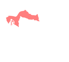
|KOORD_LAENGE=8/37/41/W | |||
|KOORD_BREITE=52/39/53/N | |||
|KOORD_KBS=1 | |||
|KOORD_ZGM=14 | |||
|POSITIONSKARTE=Tír na nÓg | |||
|POS_LABEL=Limerick | |||
|POSKARTE_OVERLAY= | |||
}} | |||
{{Stadt | |||
|STAND=? | |||
|NAME_OVR=Libreville | |||
|KOORD_DISPLAY=1 | |||
|KOORD_LAENGE=9/27/15/O | |||
|KOORD_BREITE=0/23/40/N | |||
|KOORD_KBS=1 | |||
|KOORD_ZGM=13 | |||
|POSITIONSKARTE=Bakongo | |||
|POSKARTE_OVERLAY= | |||
|POS_LABEL=Libreville | |||
}} | }} | ||
{{Stadt | |||
|STAND=? | |||
|STATUS=ehem. Hauptstadt Ruandas | |||
|LAND=[[Kongo DMZ]] (ehem. [[Ruanda]]) | |||
|KOORD={{Koord|1|57|0|S|30|4|0|O|1|13}} | |||
|KOORD_DISPLAY=1 | |||
|KOORD_LAENGE=30/4/0/O | |||
|KOORD_BREITE=1/57/0/S | |||
|KOORD_KBS=1 | |||
|KOORD_ZGM=13 | |||
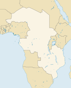
|POSITIONSKARTE=Kongo DMZ | |||
|POSKARTE_OVERLAY= | |||
|POS_LABEL=Kigali | |||
|KARTE= | |||
}} | |||
{{Stadt | {{Stadt | ||
|STAND=? | |STAND=? | ||
| Zeile 43: | Zeile 1.280: | ||
|POSKARTE_OVERLAY=Overlay Pueblo Mojave.png | |POSKARTE_OVERLAY=Overlay Pueblo Mojave.png | ||
}} | }} | ||
{{Stadt | {{Stadt | ||
|STAND=? | |STAND=? | ||
|NAME_OVR=Santiago de Compostela<br/><small>Place to meet the 'Ladies of Spain'</small> | |||
|WAPPEN= | |||
|COPYRIGHT= | |||
|LAGE=[[Galizien]], [[Spanien]] | |||
|KOORD_DISPLAY=1 | |||
|KOORD_LAENGE=8/32/0/W | |||
|KOORD_BREITE=42/53/0/N | |||
|KOORD_KBS=1 | |||
|ZGM=12 | |||
|POSITIONSKARTE=Spanien | |||
}} | |||
{{Stadt | |||
|STAND=? | |||
|NAME_OVR=Kaff in Froonkreisch | |||
|WAPPEN= | |WAPPEN= | ||
|COPYRIGHT= | |COPYRIGHT= | ||
|LAGE= | |LAGE= | ||
|KOORD_DISPLAY=1 | |KOORD_DISPLAY=1 | ||
|KOORD_LAENGE= | |KOORD_LAENGE=4/2/5/O | ||
|KOORD_BREITE= | |KOORD_BREITE=49/15/46/N | ||
|KOORD_KBS=1 | |KOORD_KBS=1 | ||
|ZGM=12 | |ZGM=12 | ||
|POSITIONSKARTE=Frankreich | |POSITIONSKARTE=Frankreich | ||
|POS_LABEL=Reims | |||
}} | }} | ||
{{Stadt | {{Stadt | ||
| Zeile 71: | Zeile 1.322: | ||
}} | }} | ||
{{Stadtteil | {{Stadtteil | ||
|STADT= | |NAME_OVR=Maadi<br/>el-Maadi | ||
| | |STAND=2080 | ||
|STADT=Kairo | |||
|ALTERNATIV=arab. المعادي, al-Maʿādī | |||
|KOORD_DISPLAY=1 | |KOORD_DISPLAY=1 | ||
|KOORD_LAENGE= | |KOORD_LAENGE=31/15/0/O | ||
|KOORD_BREITE= | |KOORD_BREITE=29/58/0/N | ||
|KOORD_KBS=1 | |KOORD_KBS=1 | ||
|KOORD_ZGM=13 | |KOORD_ZGM=13 | ||
|POSITIONSKARTE= | |POSITIONSKARTE=Ägypten | ||
|POS_LABEL=el-Maadi | |||
}} | }} | ||
{{ | {{Stadt | ||
| | |NAME_OVR=Meißen | ||
| | |STAND=2080 | ||
|KOORD_DISPLAY=1 | |KOORD_DISPLAY=1 | ||
|KOORD_LAENGE= | |KOORD_LAENGE=13/28/39/O | ||
|KOORD_BREITE= | |KOORD_BREITE=51/9/49/N | ||
|KOORD_KBS=1 | |KOORD_KBS=1 | ||
|KOORD_ZGM=13 | |KOORD_ZGM=13 | ||
|POSITIONSKARTE=ADL | |||
|POSITIONSKARTE= | |POS_LABEL=Meißen | ||
| | |||
}} | }} | ||
{{Stadt | {{Stadt | ||
| Zeile 98: | Zeile 1.350: | ||
|BUNDESSTAAT= | |BUNDESSTAAT= | ||
|BUNDESLAND= | |BUNDESLAND= | ||
|COUNTY= | |COUNTY= | ||
|PROVINZ=England | |PROVINZ=England | ||
|LAGE= | |LAGE= | ||
|FLÄCHE= | |FLÄCHE= | ||
|KOORD_DISPLAY=1 | |KOORD_DISPLAY=1 | ||
|KOORD_LAENGE= | |KOORD_LAENGE=4/8/9.6/W | ||
|KOORD_BREITE=50/ | |KOORD_BREITE=50/22/18.84/N | ||
|KOORD_KBS=1 | |KOORD_KBS=1 | ||
|POSITIONSKARTE=Großbritannien | |POSITIONSKARTE=Großbritannien | ||
| | |POS_LABEL=Plymouth | ||
}} | |||
{{Stadt | |||
|STAND=? | |||
|LAND=[[CAS]] | |||
|BUNDESSTAAT=Texas | |||
|BUNDESLAND= | |||
|COUNTY=Brazos County | |||
|PROVINZ= | |||
|LAGE= | |||
|FLÄCHE= | |||
|KOORD_DISPLAY=1 | |||
|KOORD_LAENGE=96/18/52/W | |||
|KOORD_BREITE=30/36/5/N | |||
|KOORD_KBS=1 | |||
|POSITIONSKARTE=CAS | |||
|POS_LABEL=College Sation | |||
}} | }} | ||
{{Stadt | {{Stadt | ||
| Zeile 117: | Zeile 1.385: | ||
|KOORD_ZGM=13 | |KOORD_ZGM=13 | ||
|POSITIONSKARTE=Balkan-Konfliktzone | |POSITIONSKARTE=Balkan-Konfliktzone | ||
|POSKARTE_OVERLAY=Overlay Balkan-Konfliktzone Montenegro.png | |POSKARTE_OVERLAY=Overlay Balkan-Konfliktzone Freies Mazedonien.png | ||
}} | |||
{{Region | |||
|STAND=? | |||
|FRAKTIONEN= | |||
:[[UNPROFOR]] | |||
|POSITIONSKARTE=Balkan-Konfliktzone | |||
|POSKARTE_OVERLAY=Overlay Balkan-Konfliktzone Freies Mazedonien.png | |||
}} | |||
{{Staat | |||
|FLAGGE=Flagge Montenegro.png | |||
|STAND=? | |||
|POSITIONSLAGEKARTE=Balkan-Konfliktzone | |||
|POSKARTE_OVERLAY=Overlay Balkan-Konfliktzone Kosovo.png | |||
}} | |||
<br style="clear:both"/> | |||
==Universitätenkarte== | |||
Die Universitätenkarte mit inoffiziellen Zusätzen: | |||
===Karte=== | |||
<center> | |||
{| class="infobox" | |||
| | |||
{{Positionskarte Anfang|KARTE=ADL|BREITE=500}} | |||
<!-- Fehler beim Erstellen des Vorschaubildes: /bin/bash: /usr/bin/convert: No such file or directory Error code: 127 | |||
{{Positionskarte Overlay | |||
|KARTE=ADL|BREITE=500|OVERLAY=Overlay ADL Rhein-Ruhr.png}} | |||
---> | |||
{{Positionskarte Marker | |||
|KARTE=ADL|KOORD_LAENGE=7/45/11/O|KOORD_BREITE=49/25/26/N|BREITE=500 | |||
|MARKERVERWEIS=|MARKERTEXT=TU Kaiserslautern | |||
}} | |||
{{Positionskarte Marker | |||
|KARTE=ADL|KOORD_LAENGE=11/34/49/O|KOORD_BREITE=48/9/3/N|BREITE=500 | |||
|MARKERVERWEIS=|MARKERTEXT=LMU München | |||
}} | |||
{{Positionskarte Marker | |||
|KARTE=ADL|KOORD_LAENGE=11/33/13.1/O|KOORD_BREITE=48/9/18.1/N|BREITE=500 | |||
|MARKERVERWEIS=|MARKERTEXT=FH München | |||
}} | |||
{{Positionskarte Marker | |||
|KARTE=ADL|KOORD_LAENGE=13/22/8.87/O|KOORD_BREITE=52/31/12.44/N|BREITE=500 | |||
|MARKERVERWEIS=|MARKERTEXT=Horizon Universität Berlin | |||
}} | |||
{{Positionskarte Marker | |||
|KARTE=ADL|KOORD_LAENGE=13/17/26/O|KOORD_BREITE=52/27/11/N|BREITE=500 | |||
|MARKERVERWEIS=|MARKERTEXT=Freie Universität Berlin | |||
}} | |||
{{Positionskarte Marker | |||
|KARTE=ADL|KOORD_LAENGE=14/19/35/O|KOORD_BREITE=51/46/2/N|BREITE=500 | |||
|MARKERVERWEIS=|MARKERTEXT=Technische Universität Cottbus | |||
}} | |||
{{Positionskarte Marker | |||
|KARTE=ADL|KOORD_LAENGE=13/22/28/O|KOORD_BREITE=54/5/40/N|BREITE=500 | |||
|MARKERVERWEIS=|MARKERTEXT=Ernst-Moritz-Arndt-Universität Greifswald | |||
}} | |||
{{Positionskarte Marker | |||
|KARTE=ADL|KOORD_LAENGE=7/6/48/O|KOORD_BREITE=50/32/41/N|BREITE=500 | |||
|MARKERVERWEIS=|MARKERTEXT=Bundeswehrhochschule für Hermetik | |||
}} | |||
{{Positionskarte Marker | |||
|KARTE=ADL|KOORD_LAENGE=8/40/1.2/O|KOORD_BREITE=50/7/40.8/N|BREITE=500 | |||
|MARKERVERWEIS=|MARKERTEXT=Johann Wolfgang Goethe-Universität | |||
}} | |||
{{Positionskarte Marker | |||
|KARTE=ADL|KOORD_LAENGE=8/39/25/O|KOORD_BREITE=49/52/30/N|BREITE=500 | |||
|MARKERVERWEIS=|MARKERTEXT=Technische Hochschule Darmstadt | |||
}} | |||
{{Positionskarte Marker | |||
|KARTE=ADL|KOORD_LAENGE=8/42/23.72/O|KOORD_BREITE=49/24/37.77/N|BREITE=500 | |||
|MARKERVERWEIS=|MARKERTEXT=Ruprecht-Karls-Universität Heidelberg | |||
}} | |||
{{Positionskarte Marker | |||
|KARTE=ADL|KOORD_LAENGE=8/21/45/O|KOORD_BREITE=49/37/53/N|BREITE=500 | |||
|MARKERVERWEIS=|MARKERTEXT=Neues Kabbala-Forum | |||
}} | |||
{{Positionskarte Marker | |||
|KARTE=ADL|KOORD_LAENGE=9/57/34/O|KOORD_BREITE=53/34/28/N|BREITE=500 | |||
|MARKERVERWEIS=|MARKERTEXT=DeMeKo-Akademie | |||
}} | |||
{{Positionskarte Marker | |||
|KARTE=ADL|KOORD_LAENGE=10/6/34.21/O|KOORD_BREITE=53/34/8.26/N|BREITE=500 | |||
|MARKERVERWEIS=|MARKERTEXT=Helmut-Schmidt-Universität | |||
}} | |||
{{Positionskarte Marker | |||
|KARTE=ADL|KOORD_LAENGE=9/59/36/O|KOORD_BREITE=53/33/02/N|BREITE=500 | |||
|MARKERVERWEIS=|MARKERTEXT=Sammelmarker für Universität für Cybertechnologie und Hermetische Magie / Fachhochschule für Nautische und Umweltmagie / Hanseatische Akademie für magische Künste | |||
}} | |||
{{Positionskarte Marker | |||
|KARTE=ADL|KOORD_LAENGE=8/40/38/O|KOORD_BREITE=50/34/49.3/N|BREITE=500 | |||
|MARKERVERWEIS=|MARKERTEXT=Justus-Liebig-Universität Giessen | |||
}} | |||
{{Positionskarte Marker | |||
|KARTE=ADL|KOORD_LAENGE=8/46/25.32/O|KOORD_BREITE=50/48/38.47/N|BREITE=500 | |||
|MARKERVERWEIS=|MARKERTEXT=Philipps-Universität Marburg | |||
}} | |||
{{Positionskarte Marker | |||
|KARTE=ADL|KOORD_LAENGE=8/51/12.98/O|KOORD_BREITE=53/6/31.17/N|BREITE=500 | |||
|MARKERVERWEIS=|MARKERTEXT=Universität Bremen | |||
}} | |||
{{Positionskarte Marker | |||
|KARTE=ADL|KOORD_LAENGE=8/39/0/O|KOORD_BREITE=53/10/0/N|BREITE=500 | |||
|MARKERVERWEIS=|MARKERTEXT=Jacobs University Bremen | |||
}} | |||
{{Positionskarte Marker | |||
|KARTE=ADL|KOORD_LAENGE=10/20/4/O|KOORD_BREITE=51/48/16/N|BREITE=500 | |||
|MARKERVERWEIS=|MARKERTEXT=Bergakademie Clausthal-Zellerfeld | |||
}} | |||
{{Positionskarte Marker | |||
|KARTE=ADL|KOORD_LAENGE=9/56/4.11/O|KOORD_BREITE=51/32/30.7/N|BREITE=500 | |||
|MARKERVERWEIS=|MARKERTEXT=Georg-August-Universität Göttingen | |||
}} | |||
{{Positionskarte Marker | |||
|KARTE=ADL|KOORD_LAENGE=9/44/19/O|KOORD_BREITE=52/22/28/N|BREITE=500 | |||
|MARKERVERWEIS=|MARKERTEXT=Universitäten Hannover | |||
}} | |||
{{Positionskarte Marker | |||
|KARTE=ADL|KOORD_LAENGE=9/3/33/O|KOORD_BREITE=48/31/28.7/N|BREITE=500 | |||
|MARKERVERWEIS=|MARKERTEXT=Eberhard-Karls-Universität Tübingen | |||
}} | |||
{{Positionskarte Marker | |||
|KARTE=ADL|KOORD_LAENGE=9/47/19/O|KOORD_BREITE=48/5/53/N|BREITE=500 | |||
|MARKERVERWEIS=|MARKERTEXT=Rolf-Zinkernagel-Konzernuniversität | |||
}} | |||
{{Positionskarte Marker | |||
|KARTE=ADL|KOORD_LAENGE=7/36/47/O|KOORD_BREITE=51/57/49/N|BREITE=500 | |||
|MARKERVERWEIS=|MARKERTEXT=Westphälische Wilhelms-Universität Münster | |||
}} | |||
{{Positionskarte Marker | |||
|KARTE=ADL|KOORD_LAENGE=11/35/22/O|KOORD_BREITE=50/55/46/N|BREITE=500 | |||
|MARKERVERWEIS=|MARKERTEXT=Schiller-Universität Jena | |||
}} | |||
{{Positionskarte Marker | |||
|KARTE=ADL|KOORD_LAENGE=11/0/39/O|KOORD_BREITE=50/59/29/N|BREITE=500 | |||
|MARKERVERWEIS=|MARKERTEXT=Neue Universität Erfurt | |||
}} | |||
{{Positionskarte Marker | |||
|KARTE=ADL|KOORD_LAENGE=12/22/21/O|KOORD_BREITE=51/20/21/N|BREITE=500 | |||
|MARKERVERWEIS=|MARKERTEXT=Herzog-August-Universität Leipzig | |||
}} | |||
{{Positionskarte Marker | |||
|KARTE=ADL|KOORD_LAENGE=7/6/8/O|KOORD_BREITE=50/44/2/N|BREITE=500 | |||
|MARKERVERWEIS=|MARKERTEXT=Friedrich-Wilhelms-Campus Bonn (Neue Ruhr-Universität) | |||
}} | |||
{{Positionskarte Marker | |||
|KARTE=ADL|KOORD_LAENGE=7/13/1/O|KOORD_BREITE=51/28/57/N|BREITE=500 | |||
|MARKERVERWEIS=|MARKERTEXT=Neue Ruhr-Universität Bochum | |||
}} | |||
{{Positionskarte Marker | |||
|KARTE=ADL|KOORD_LAENGE=7/27/55/O|KOORD_BREITE=51/30/50/N|BREITE=500 | |||
|MARKERVERWEIS=|MARKERTEXT=Neue Ruhr-Universität Dortmund | |||
}} | |||
{{Positionskarte Marker | |||
|KARTE=ADL|KOORD_LAENGE=6/46/0/O|KOORD_BREITE=51/25/60/N|BREITE=500 | |||
|MARKERVERWEIS=|MARKERTEXT=Neue Ruhr-Universität Duisburg | |||
}} | |||
{{Positionskarte Marker | |||
|KARTE=ADL|KOORD_LAENGE=7/0/53.14/O|KOORD_BREITE=51/27/29.05/N|BREITE=500 | |||
|MARKERVERWEIS=|MARKERTEXT=Neue Ruhr-Universität Essen | |||
}} | |||
{{Positionskarte Marker | |||
|KARTE=ADL|KOORD_LAENGE=6/57/28/O|KOORD_BREITE=50/56/32/N|BREITE=500 | |||
|MARKERVERWEIS=|MARKERTEXT=Neue Ruhr-Universität Köln | |||
}} | |||
{{Positionskarte Marker | |||
|KARTE=ADL|KOORD_LAENGE=11/0/25/O|KOORD_BREITE=49/35/50/N|BREITE=500 | |||
|MARKERVERWEIS=|MARKERTEXT=Friedrich-Alexander-Universität Erlangen-Nürnberg | |||
}} | |||
{{Positionskarte Marker | |||
|KARTE=ADL|KOORD_LAENGE=11/35/9/O|KOORD_BREITE=49/55/44/N|BREITE=500 | |||
|MARKERVERWEIS=|MARKERTEXT=Universität Bayreuth | |||
}} | |||
{{Positionskarte Marker | |||
|KARTE=ADL|KOORD_LAENGE=7/50/49.05/O|KOORD_BREITE=47/59/38.98/N|BREITE=500 | |||
|MARKERVERWEIS=|MARKERTEXT=Albert-Ludwigs-Universität Freiburg | |||
}} | |||
{{Positionskarte Marker | |||
|KARTE=ADL|KOORD_LAENGE=6/5/1/O|KOORD_BREITE=50/46/36/N|BREITE=500 | |||
|MARKERVERWEIS=|MARKERTEXT=Universitäten Aachens | |||
}} | |||
{{Positionskarte Marker | |||
|KARTE=ADL|KOORD_LAENGE=13/5/0/O|KOORD_BREITE=54/18/0/N|BREITE=500 | |||
|MARKERVERWEIS=|MARKERTEXT=Hochschule Strelasund | |||
}} | |||
{{Positionskarte Marker | |||
|KARTE=ADL|KOORD_LAENGE=10/24/4/O|KOORD_BREITE=53/13/44/N|BREITE=500 | |||
|MARKERVERWEIS=|MARKERTEXT=Leuphana Universität Lüneburg | |||
}} | |||
{{Positionskarte Marker | |||
|KARTE=ADL|KOORD_LAENGE=13/43/36/O|KOORD_BREITE=51/1/41/N|BREITE=500 | |||
|MARKERVERWEIS=|MARKERTEXT=Technische Universität Dresden | |||
}} | |||
{{Positionskarte Marker | |||
|KARTE=ADL|KOORD_LAENGE=8/29/35/O|KOORD_BREITE=52/2/16/N|BREITE=500 | |||
|MARKERVERWEIS=|MARKERTEXT=Universität Bielefeld | |||
}} | |||
{{Positionskarte Marker | |||
|KARTE=ADL|KOORD_LAENGE=9/11/17.16/O|KOORD_BREITE=47/41/24.77/N|BREITE=500 | |||
|MARKERVERWEIS=|MARKERTEXT=Universität Konstanz | |||
}} | |||
{{Positionskarte Marker | |||
|KARTE=ADL|KOORD_LAENGE=8/53/0/O|KOORD_BREITE=51/56/0/N|BREITE=500 | |||
|MARKERVERWEIS=|MARKERTEXT=Musikhochschule Detmold | |||
}} | |||
{{Positionskarte Marker | |||
|KARTE=ADL|KOORD_LAENGE=8/46/20/O|KOORD_BREITE=51/42/29/N|BREITE=500 | |||
|MARKERVERWEIS=|MARKERTEXT=Universität Paderborn | |||
}} | |||
{{Positionskarte Marker | |||
|KARTE=ADL|KOORD_LAENGE=8/27/52.87/O|KOORD_BREITE=49/28/59.51/N|BREITE=500 | |||
|MARKERVERWEIS=|MARKERTEXT=Universität Mannheim | |||
}} | |||
{{Positionskarte Marker | |||
|KARTE=ADL|KOORD_LAENGE=10/7/21/O|KOORD_BREITE=54/20/20/N|BREITE=500 | |||
|MARKERVERWEIS=|MARKERTEXT=Christian-Albrechts-Universität zu Kiel | |||
}} | }} | ||
{{Positionskarte Ende}} | |||
|- | |||
|Position von Universitäten | |||
|} | |||
</center> | |||
Aktuelle Version vom 6. Dezember 2025, 01:51 Uhr
| Das Labor ist so... leer. - Schade! | |
| Dr. Marvin Mondo |
Produktbeschreibung
... more to come ...
Quellen-Infobox Zusatzmaterial
| Informationen |
| Typ: Kurzabenteuer |
Autoren:
|
| Sprache: deutsch |
| Veröffentlichung: 2003 |
| Seitenanzahl: 7 |
Karten f. Locations
| Fachhochschule München Überblick (Stand: 2064) | ||
Kurzbeschreibung:
| ||
| Koordinaten: | ||
|
| ||
| Kartoffelhaus Überblick (Stand: 2062) | ||
| Kurzbeschreibung: Restaurant | ||
| Lage: etwas hinter dem Spremberger Turm, Innenstadt von Cottbus, Land Brandenburg, ADL | ||
| Koordinaten: | ||
|
| ||
| Ludwig-Maximilians-Universität München Überblick (Stand: 2064) | ||
| Andere Bezeichnungen: LMU München | ||
Kurzbeschreibung:
| ||
| Koordinaten: | ||
|
| ||
| Freudenstrand Überblick (Stand: 2064) | ||
Kurzbeschreibung:
| ||
| Lage: Markgrafenstraße 18, Friedrichshain-Kreuzberg, Berlin | ||
| Koordinaten: | ||
|
| ||
| Universität Paderborn Überblick (Stand: 2071) | ||
Kurzbeschreibung:
| ||
| Koordinaten: | ||
|
| ||
| École Normale de Musique de Paris Überblick (Stand: 2071) | ||
Kurzbeschreibung:
| ||
| Lage: 114 bis, Boulevard Malesherbes, Innenstadt Paris, Frankreich | ||
| Koordinaten: | ||
|
| ||
| Lloyd's of London Überblick (Stand: 2064) | ||
Kurzbeschreibung:
| ||
| Lage: Lloyd's Building, London, England, UK | ||
| Koordinaten: | ||
|
| ||
| Aalborg Überblick (Stand: 2082) | ||
| Andere Bezeichnungen: Ålborg, dtsch.: Aalburg (veraltet) | ||
Kurzbeschreibung:
| ||
| Lage: Dänemark, Skandinavische Union | ||
| Koordinaten: | ||
|
| ||
| Serbien Überblick (Stand: 2082) | ||
| Koordinaten: | ||
|
| ||
| Missoula-Forschungseinrichtung Überblick (Stand: 2075) | ||
| Koordinaten: | ||
| Besitzer: Gaeatronics | ||
|
| ||
| Grande Überblick (Stand: 2080) | ||
| Koordinaten: | ||
|
| ||
| Ernst-Moritz-Arndt-Universität Greifswald Überblick (Stand: 2080) | ||
| Koordinaten: | ||
|
| ||
| Kroatien Überblick (Stand: 2082) | ||
| Koordinaten: | ||
|
| ||
| Jodel-Babuschka Überblick (Stand: 2082) | ||
Kurzbeschreibung:
| ||
| Lage: Tiefparterre / Keller, zentral an der Hauptstraße, Oberwiesenthal, Erzgebirge, Freistaat Sachsen, ADL | ||
| Koordinaten: | ||
Besitzer:
| ||
Sicherheit:
| ||
|
| ||
| Gotland Überblick (Stand: 2081) | ||
| Kurzbeschreibung: große Ostseeinsel | ||
Lage:
| ||
| Koordinaten: | ||
| Besitzer: Schweden | ||
|
| ||
| Livländische Ordensburg Überblick (Stand: 2081) | ||
Andere Bezeichnungen:
| ||
Kurzbeschreibung:
| ||
| Erbaut: 1290 | ||
| Lage: Ventspils, Lettland | ||
| Koordinaten: | ||
|
| ||
| Saaremaa Überblick (Stand: 2081) | ||
| Koordinaten: | ||
|
| ||
| Roche Blanche de la mer Überblick (Stand: 2071) | ||
Kurzbeschreibung:
| ||
Erbaut:
| ||
Lage:
| ||
| Koordinaten: | ||
| Besitzer: Frankreich / Eigentümergemeinschaft (in Erbpacht) | ||
| Sicherheit: Securité SA | ||
|
| ||
| Haus Dallmayr Überblick (Stand: 2080) | ||
| Kurzbeschreibung: Feinkostgeschäft / Brasserie / Restaurant / Stammsitz | ||
Lage:
| ||
| Koordinaten: | ||
| Besitzer: Dallmayr | ||
| Sicherheit: Schwarze Sheriffs | ||
|
| ||
| Oberlandesgericht Düsseldorf Überblick (Stand: 2083) | ||
| Kurzbeschreibung: Gerichtsgebäude | ||
Lage:
| ||
| Koordinaten: | ||
| Besitzer: Land Nordrhein-Ruhr | ||
| Sicherheit: Ruhrpolizei | ||
|
| ||
| Café Dommayer Überblick (Stand: {{{STAND}}}) | ||
Kurzbeschreibung:
| ||
| Koordinaten: | ||
|
| ||
| Château du Haut-Kœnigsbourg Überblick (Stand: 2050er/60er) | ||
Andere Bezeichnungen:
| ||
| Kurzbeschreibung: Schloss (Familiensitz) | ||
Lage:
| ||
| Koordinaten: | ||
| Besitzer: Familie Kœnigsbourg | ||
|
| ||
| Prison de Champ-Dollon Überblick (Stand: {{{STAND}}}) | ||
| Koordinaten: | ||
|
| ||
| Homburg-Saar Überblick (Stand: {{{STAND}}}) | ||
Kurzbeschreibung:
| ||
| Koordinaten: | ||
|
| ||
| Hängende Kirche Überblick (Stand: {{{STAND}}}) | ||
Kurzbeschreibung:
| ||
| Koordinaten: | ||
|
| ||
| Universität Venedig Überblick (Stand: {{{STAND}}}) | ||
Kurzbeschreibung:
| ||
| Koordinaten: | ||
|
| ||
| Tortola Überblick (Stand: 2059) | ||
Kurzbeschreibung:
| ||
| Koordinaten: | ||
|
| ||
| St. Barthélémy Überblick (Stand: 2059) | ||
Kurzbeschreibung:
| ||
| Koordinaten: | ||
|
| ||
| Ibiza (katalan. Eivissa) Überblick (Stand: 2073) | ||
Kurzbeschreibung:
| ||
Lage:
| ||
| Koordinaten: | ||
|
| ||
| Kathe/Labor Überblick (Stand: 2073) | ||
Kurzbeschreibung:
| ||
Lage:
| ||
| Koordinaten: | ||
|
| ||
| Rächionoolfluchhaaf'n Überblick (Stand: ?) | ||
| Koordinaten: | ||
|
| ||
| Kathe/Labor Überblick (Stand: ???) | ||
| Kurzbeschreibung: Dunguair Castle | ||
Lage:
| ||
| Koordinaten: | ||
|
| ||
| Marktkirche (Hannover) Überblick (Stand: 2081) | ||
| Koordinaten: | ||
|
| ||
| Psychiatrie Dortmund Aplerbeck Überblick (Stand: 2080) | ||
| Kurzbeschreibung: Psychiatrische Anstalt | ||
| Lage: Dortmund Aplerbeck, Rhein-Ruhr-Megaplex, Nordrhein-Ruhr, ADL | ||
| Koordinaten: | ||
|
| ||
| Frankenstadion Überblick (Stand: 2081) | ||
| Kurzbeschreibung: Fußballstadion | ||
| Lage: Nürnberg, NEF-Sprawl, Franken, ADL | ||
| Koordinaten: | ||
|
| ||
| Schattenhafen am Urban Überblick (Stand: 2081) | ||
| Andere Bezeichnungen: Urbanhafen | ||
| Kurzbeschreibung: Flusshafen (Schmuggelhotspot) | ||
| Lage: Friedrichshain-Kreuzberg, Berlin | ||
| Koordinaten: | ||
| Betreiber: Spreeratten, ehem. umkämpft (Vory, Graue Wölfe, Balkanmafia) | ||
| Sicherheit: Ganger der Spreeratten, bewaffnete Anwohner, ehem. Syndikatsschläger (Vory, Graue Wölfe, Balkanmafia) | ||
|
| ||
| Universität Norwich Überblick (Stand: 2083) | ||
| Kurz: UEA | ||
| Andere Bezeichnungen: University of East Anglia | ||
| Kurzbeschreibung: Campus-Universität | ||
| Lage: Norwich in der Grafschaft Norfolk im Osten Englands (UK) | ||
| Koordinaten: | ||
|
| ||
Karten für Städte
| Wrocław Überblick (Stand: {{{STAND}}}) | ||
| Koordinaten: | ||
|
| ||
| Kista (Stockholm) Überblick (Stand:2083) | ||
| Kurzbeschreibung: IT-Zentrum / -Oase | ||
| Koordinaten: | ||
|
| ||
| Norwich Überblick (Stand: ) | ||
| Koordinaten: | ||
|
| ||
| SVZ Recklinghausen Überblick (Stand: ) | ||
| Koordinaten: | ||
|
| ||
| Tartu Überblick (Stand: 2081) | ||
| Koordinaten: | ||
|
| ||
| Kuressaare Überblick (Stand: 2081) | ||
| Koordinaten: | ||
|
| ||
| Acapulco Überblick (Stand: ?) | ||
| Koordinaten: | ||
|
| ||
| Salzgitter Überblick (Stand: 2081) | ||
| Status: Ortschaft | ||
| Koordinaten: | ||
Industrie:
| ||
|
| ||
| Falun Überblick (Stand: ?) | ||
| Status: Tatört | ||
| Koordinaten: | ||
Industrie:
| ||
|
| ||
| Ciudad Juárez (El Paso/Ciudad Juárez-Sprawl) Überblick (Stand:2078) | ||
| Sicherheitskräfte: Aztechnology Corporate Security | ||
| Rettungsdienst: MedíCarro (?) / (Keine Ärzte ohne Grenzen!) | ||
|
| ||
| Hamamatsu Überblick (Stand: ????) | ||
| Koordinaten: | ||
|
| ||
| Haguenau Überblick (Stand: 2050er/60er) | ||
| Koordinaten: | ||
|
| ||
| Kotzen Überblick (Stand: 2062) | ||
| Status: Ortschaft | ||
| Koordinaten: | ||
|
| ||
| Steinen Überblick (Stand: 2080) | ||
| Status: aufgegebene Dörflein (Paranormale Gefahrenzone Klasse C) | ||
| Koordinaten: | ||
| Einwohnerzahl: offiziell keine (faktisch: 1 Geist) | ||
|
| ||
| Besigheim Überblick (Stand: 2080) | ||
| Status: aufgegebene Kleinstadt | ||
| Koordinaten: | ||
|
| ||
| „Sonnenspeer“ (Motzen) Überblick (Stand: 2080) | ||
| Andere Bezeichnungen: Motzen | ||
| Status: Geisterdorf / Nazikommune | ||
| Koordinaten: | ||
|
| ||
| Jonesboro Überblick (Stand: 2080) | ||
| Koordinaten: | ||
|
| ||
| Finow (Ebertswalde) Überblick (Stand:2078) | ||
| Koordinaten: | ||
|
| ||
| Metzingen (Stuttgart) Überblick (Stand:2078) | ||
| Koordinaten: | ||
|
| ||
| Hamburg-Hamm (Hamburg) Überblick (Stand:2078) | ||
| Koordinaten: | ||
|
| ||
| Wattenscheid (Bochum) Überblick (Stand:2078) | ||
| Kurzbeschreibung: Braunes Loch (d.h. Zentrum von Rassismus und Spießigkeit) | ||
| Koordinaten: | ||
| Sicherheitskräfte: Landespolizei Nordrhein-Ruhr | ||
Kriminelle Aktivitäten:
| ||
|
| ||
| Hoffenheim Überblick (Stand: 2080) | ||
| Koordinaten: | ||
|
| ||
| Bismarck (Hauptstadt North Dakotas) Überblick (Stand: ?) | ||
| Koordinaten: | ||
|
| ||
| Dover (des in Delaware - net in England!) Überblick (Stand: ?) | ||
| Koordinaten: | ||
|
| ||
| Schwäbisch Hall Überblick (Stand: ?) | ||
| Koordinaten: | ||
|
| ||
| Cancún Überblick (Stand: ?) | ||
| Koordinaten: | ||
|
| ||
| Cancún Überblick (Stand: ?) | ||
| Koordinaten: | ||
|
| ||
| Passau Überblick (Stand: ?) | ||
| Status: Stadt der Passauer Verträge | ||
| Koordinaten: | ||
|
| ||
| Kathe/Labor Überblick (Stand: ?) | ||
| Koordinaten: | ||
|
| ||
| Kathe/Labor Überblick (Stand: ?) | ||
| Koordinaten: | ||
|
| ||
| Kathe/Labor Überblick (Stand: ?) | ||
| Koordinaten: | ||
|
| ||
| Limerick Überblick (Stand: ?) | ||
| Koordinaten: | ||
|
| ||
| Libreville Überblick (Stand: ?) | ||
| Koordinaten: | ||
|
| ||
| Kathe/Labor Überblick (Stand: ?) | ||
| Status: ehem. Hauptstadt Ruandas | ||
| Koordinaten: | ||
|
| ||
| Kathe/Labor Überblick (Stand: ?) | ||
| Koordinaten: | ||
|
| ||
| Santiago de Compostela Place to meet the 'Ladies of Spain' Überblick (Stand: ?) | ||
| Koordinaten: | ||
|
| ||
| Kaff in Froonkreisch Überblick (Stand: ?) | ||
| Koordinaten: | ||
|
| ||
| Kathe/Labor Überblick (Stand: 2067) | ||
|
| ||
| Status: Hauptstadt | ||
| Koordinaten: | ||
| Fläche: ca. 268,00 km² | ||
| Einwohnerzahl: 30.488.984 | ||
| Personen ohne SIN: 65% | ||
|
| ||
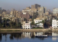
| Maadi el-Maadi (Kairo) Überblick (Stand:2080) | ||
| Alternativbezeichnung: arab. المعادي, al-Maʿādī | ||
| Koordinaten: | ||
|
| ||
| Meißen Überblick (Stand: 2080) | ||
| Koordinaten: | ||
|
| ||
| Kathe/Labor Überblick (Stand: ?) | ||
| Koordinaten: | ||
|
| ||
| Kathe/Labor Überblick (Stand: ?) | ||
| Koordinaten: | ||
|
| ||
| Kathe/Labor Überblick (Stand: ?) | ||
| Koordinaten: | ||
|
| ||
| Kathe/Labor Überblick (Stand:?) |
| Fraktionen: |
| Kathe/Labor Überblick (Stand: ?) | |
|
|
Universitätenkarte
Die Universitätenkarte mit inoffiziellen Zusätzen:
Karte
|
| |
| Position von Universitäten |
