Datei:Fläche ägypten 1 merc n3510.svg: Unterschied zwischen den Versionen
Zur Navigation springen
Zur Suche springen
Loki (Diskussion | Beiträge) ({{Karteninfo |LIZENZ=[http://creativecommons.org/licenses/by-nc-sa/3.0/ Creative Commons Attribution-Noncommercial-Share Alike 3.0] |PROJEKTION=Mercator-Projektion, Standard-Longitude: 0° oestl. Laenge |QUELLE=Global Administrative Areas [http://www.gadm) |
Loki (Diskussion | Beiträge) KKeine Bearbeitungszusammenfassung |
||
| Zeile 9: | Zeile 9: | ||
<pre> | <pre> | ||
32. | 32.307625 31.261025 | ||
32. | 32.301228 31.256314 | ||
32. | 32.297572 31.246108 | ||
32. | 32.297572 31.206843 | ||
32. | 32.302142 31.111753 | ||
32. | 32.314022 30.819596 | ||
32. | 32.318591 30.80382 | ||
32. | 32.342351 30.720957 | ||
32. | 32.324074 30.621426 | ||
32. | 32.313108 30.607199 | ||
32. | 32.306711 30.592179 | ||
32. | 32.303055 30.573994 | ||
32. | 32.305797 30.563714 | ||
32. | 32.33504 30.52733 | ||
32. | 32.336868 30.518627 | ||
32. | 32.343265 30.504385 | ||
32. | 32.345092 30.483809 | ||
32. | 32.349662 30.463228 | ||
32. | 32.353317 30.450561 | ||
32. | 32.360628 30.439476 | ||
32. | 32.361542 30.425222 | ||
32. | 32.381646 30.359467 | ||
32. | 32.412717 30.315078 | ||
32. | 32.450185 30.283358 | ||
32. | 32.479428 30.268288 | ||
32. | 32.526034 30.255596 | ||
32. | 32.558019 30.227825 | ||
32. | 32.56533 30.205602 | ||
32. | 32.566244 30.150818 | ||
32. | 32.56533 30.114279 | ||
32. | 32.56533 30.08011 | ||
32. | 32.570813 30.041158 | ||
32. | 32.579952 30.008554 | ||
32. | 32.585435 29.989464 | ||
32. | 32.587262 29.981509 | ||
32. | 32.588176 29.969575 | ||
32. | 32.584521 29.952864 | ||
32. | 32.575382 29.946498 | ||
</pre> | </pre> | ||
| Zeile 52: | Zeile 52: | ||
<pre> | <pre> | ||
33. | 33.161168 8.486145 | ||
33. | 33.069202 8.620408 | ||
32. | 32.915926 8.748522 | ||
32. | 32.738125 8.882689 | ||
32. | 32.578717 8.974139 | ||
32. | 32.388654 9.047281 | ||
32. | 32.241508 9.120409 | ||
32. | 32.033052 9.187429 | ||
31. | 31.800071 9.260527 | ||
31. | 31.554829 9.321431 | ||
31. | 31.407683 9.364057 | ||
31. | 31.21762 9.418854 | ||
31. | 31.039819 9.461468 | ||
30. | 30.904936 9.485816 | ||
30. | 30.770052 9.497989 | ||
30. | 30.671955 9.491903 | ||
30. | 30.635168 9.467555 | ||
30. | 30.616775 9.418854 | ||
30. | 30.610644 9.327521 | ||
30. | 30.579989 9.297071 | ||
30. | 30.432843 9.327521 | ||
30. | 30.255042 9.357967 | ||
30 9. | 30 9.388412 | ||
30 18 | 30 18 | ||
25 22 | 25 22 | ||
</pre> | </pre> | ||
Version vom 25. Juli 2010, 14:21 Uhr
| Übersicht | |
|---|---|
| Lizenz | Creative Commons Attribution-Noncommercial-Share Alike 3.0 |
| Projektion | Mercator-Projektion, Standard-Longitude: 0° oestl. Laenge |
| Datenquelle | Global Administrative Areas [1] Shadowrun-Karten (in Form übertragener Geodaten) |
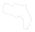
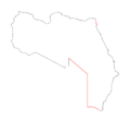
Korrekturlinie 1: Ägypten--Israel
32.307625 31.261025
32.301228 31.256314
32.297572 31.246108
32.297572 31.206843
32.302142 31.111753
32.314022 30.819596
32.318591 30.80382
32.342351 30.720957
32.324074 30.621426
32.313108 30.607199
32.306711 30.592179
32.303055 30.573994
32.305797 30.563714
32.33504 30.52733
32.336868 30.518627
32.343265 30.504385
32.345092 30.483809
32.349662 30.463228
32.353317 30.450561
32.360628 30.439476
32.361542 30.425222
32.381646 30.359467
32.412717 30.315078
32.450185 30.283358
32.479428 30.268288
32.526034 30.255596
32.558019 30.227825
32.56533 30.205602
32.566244 30.150818
32.56533 30.114279
32.56533 30.08011
32.570813 30.041158
32.579952 30.008554
32.585435 29.989464
32.587262 29.981509
32.588176 29.969575
32.584521 29.952864
32.575382 29.946498
Korrekturlinie 1: Ägypten--Kongo-Stammesland
33.161168 8.486145
33.069202 8.620408
32.915926 8.748522
32.738125 8.882689
32.578717 8.974139
32.388654 9.047281
32.241508 9.120409
32.033052 9.187429
31.800071 9.260527
31.554829 9.321431
31.407683 9.364057
31.21762 9.418854
31.039819 9.461468
30.904936 9.485816
30.770052 9.497989
30.671955 9.491903
30.635168 9.467555
30.616775 9.418854
30.610644 9.327521
30.579989 9.297071
30.432843 9.327521
30.255042 9.357967
30 9.388412
30 18
25 22
Dateiversionen
Klicke auf einen Zeitpunkt, um diese Version zu laden.
| Version vom | Vorschaubild | Maße | Benutzer | Kommentar | |
|---|---|---|---|---|---|
| aktuell | 20:36, 31. Jul. 2010 |  | 1.000 × 916 (60 KB) | Loki (Diskussion | Beiträge) | Alignierung der Kongogrenze |
| 17:31, 25. Jul. 2010 |  | 1.000 × 916 (59 KB) | Loki (Diskussion | Beiträge) | +Korrekturlinien | |
| 14:18, 25. Jul. 2010 |  | 1.000 × 916 (58 KB) | Loki (Diskussion | Beiträge) | {{Karteninfo |LIZENZ=[http://creativecommons.org/licenses/by-nc-sa/3.0/ Creative Commons Attribution-Noncommercial-Share Alike 3.0] |PROJEKTION=Mercator-Projektion, Standard-Longitude: 0° oestl. Laenge |QUELLE=Global Administrative Areas [http://www.gadm |
Du kannst diese Datei nicht überschreiben.
Dateiverwendung
Die folgende Seite verwendet diese Datei: