Quelle, en: Sprawl Maps: Unterschied zwischen den Versionen
Zur Navigation springen
Zur Suche springen
Loki (Diskussion | Beiträge) Keine Bearbeitungszusammenfassung |
Loki (Diskussion | Beiträge) Keine Bearbeitungszusammenfassung |
||
| Zeile 11: | Zeile 11: | ||
Sprawl Maps contains 8 new, full-color maps of sites in the sprawl, including a monorail/subway station, a warehouse, a park, low- and no-rent apartments, a street, and a nightclub. | Sprawl Maps contains 8 new, full-color maps of sites in the sprawl, including a monorail/subway station, a warehouse, a park, low- and no-rent apartments, a street, and a nightclub. | ||
Designed for use with Shadowrun, Second Edition, these maps are also marked for use with DMZ. | Designed for use with Shadowrun, Second Edition, these maps are also marked for use with [[Downtown Militarized Zone (Quelle, englisch)|DMZ]]. | ||
{{KatSort|cat=Quellen||FASA Corporation|Englisch | {{KatSort|cat=Quellen||FASA Corporation|Englisch|1994}} | ||
Version vom 18. April 2012, 22:09 Uhr
Zu dem hier behandelten Thema gibt es noch eine Menge zu sagen!
| Informationen | |
|
| |
| Nummer: 7401 | |
| Erschienen: 1994 | |
| ISBN: |
"Anyplace is a good place for a shadowrun - all you need to do the deed is a map."
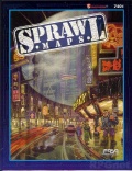
Sprawl Maps contains 8 new, full-color maps of sites in the sprawl, including a monorail/subway station, a warehouse, a park, low- and no-rent apartments, a street, and a nightclub.
Designed for use with Shadowrun, Second Edition, these maps are also marked for use with DMZ.
