Shadowhelix:Karten/Dokumentation/Staaten/Asante Nation: Unterschied zwischen den Versionen
Zur Navigation springen
Zur Suche springen
Loki (Diskussion | Beiträge) K (Die Seite wurde neu angelegt: „===Asante Nation=== *Shadowrunspezifische Strukturen: 3 Korrekturlinie *Referenz: {{Quelle|cp|S. 90, 99}}, {{Quelle|swa|Faltkarte}} ====20xx-2072==== [[Datei:Fl…“) |
(+Aenderung auf css-Style) |
||
| Zeile 6: | Zeile 6: | ||
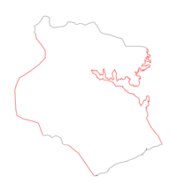
[[Datei:Fläche asante nation 1 merc n2185.svg|thumb|200px|right|[http://creativecommons.org/licenses/by-nc-sa/3.0/ Creative Commons Attribution-Noncommercial-Share Alike 3.0]]] | [[Datei:Fläche asante nation 1 merc n2185.svg|thumb|200px|right|[http://creativecommons.org/licenses/by-nc-sa/3.0/ Creative Commons Attribution-Noncommercial-Share Alike 3.0]]] | ||
{| | {| class="infotable" style="width:75%" | ||
! colspan="4" | Zusammensetzung | ! colspan="4" | Zusammensetzung | ||
|- | |- | ||
Version vom 24. Juli 2011, 07:48 Uhr
Asante Nation
- Shadowrunspezifische Strukturen: 3 Korrekturlinie
- Referenz:
| Informationen |
,
| Informationen |
20xx-2072
| Zusammensetzung | |||
|---|---|---|---|
| Struktur | Anmerkung | ||
| + | Ghana - Ashanti | ||
| + | Ghana - Central | ||
| + | Ghana - Eastern | ||
| + | Ghana - Greater Accra | ||
| * | 0.288559 5.794644 / [..] / 0.078889 7.150556 | Landgrenze Asante Nation | |
| * | -1.523206 7.369743 / [..] / -1.419677 5.920536 | Grenze Asante Nation--Gold- und Elfenbeinküste | |
| * | -1.049928 5.765018 / [..] / -0.675487 5.31959 | Grenze Asante Nation--Sekondi | |
