Von Loki hochgeladene Dateien
Zur Navigation springen
Zur Suche springen
Diese Spezialseite listet alle hochgeladenen Dateien auf.
| Datum | Name | Vorschaubild | Größe | Beschreibung | Versionen |
|---|---|---|---|---|---|
| 12:24, 2. Mär. 2019 | Lebensmodule.txt (Datei) | 9 KB | 2 | ||
| 12:23, 2. Mär. 2019 | Lebensmodule Ausprägung.txt (Datei) | 14 KB | 2 | ||
| 10:03, 22. Dez. 2018 | Cover Lateinamerika in den Schatten.jpg (Datei) |  |
370 KB | {{Bildinfo |LIZENZ=? |URHEBER=Tobias Grunow (Cover Design) |BESCHREIBUNG=Cover {{QDE|zm/lids}} }} Kategorie:!Bilder/Quellen | 1 |
| 11:25, 16. Dez. 2018 | Infografik China Territorialverlust.png (Datei) | 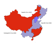 |
89 KB | {{Karteninfo |LIZENZ=[https://creativecommons.org/licenses/by-nc/4.0/ Creative Commons Attribution-NonCommercial-4.0] |PROJEKTION=Projektion, Standard-Longitude: 0° oestl. Laenge |QUELLE=Global Administrative Areas [http://www.gadm.org]<br/>CIA World… | 1 |
| 17:36, 15. Dez. 2018 | Map Sixth World turn of the year 2018-2019.png (Datei) | Fehler beim Erstellen des Vorschaubildes: Datei mit Abmessungen größer als 12,5 MP |
2,2 MB | {{Karteninfo |LIZENZ=[http://creativecommons.org/licenses/by-nc-sa/3.0/ Creative Commons Attribution-Noncommercial-Share Alike 3.0] |PROJEKTION=Robinson-Projektion, Standard-Longitude: 0° oestl. Laenge |QUELLE=Global Administrative Areas [http://www.g… | 1 |
| 12:29, 22. Mai 2018 | Karte Mongolei.svg (Datei) | 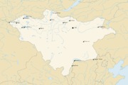 |
592 KB | 2 | |
| 22:44, 20. Mai 2018 | Weltkarte 2080 blank platt.svg (Datei) |  |
2,34 MB | {{Karteninfo |LIZENZ=[http://creativecommons.org/licenses/by-nc/4.0/ Creative Commons Attribution-NonCommercial 4.0] |QUELLE=Global Administrative Areas [http://www.gadm.org]<br/>CIA World DataBank II [http://www.evl.uic.edu/pape/data/WDB/]<br/>Shadowr… | 1 |
| 22:40, 20. Mai 2018 | Weltkarte 2080 blank robinson.svg (Datei) |  |
2,17 MB | {{Karteninfo |LIZENZ=[http://creativecommons.org/licenses/by-nc/4.0/ Creative Commons Attribution-NonCommercial 4.0] |QUELLE=Global Administrative Areas [http://www.gadm.org]<br/>CIA World DataBank II [http://www.evl.uic.edu/pape/data/WDB/]<br/>Shadowr… | 1 |
| 22:36, 20. Mai 2018 | Weltkarte 2080 blank mercator.svg (Datei) | Fehler beim Erstellen des Vorschaubildes: convert-im6.q16: delegate failed `'rsvg-convert' -o '%o' '%i'' @ error/delegate.c/InvokeDelegate/1966.
convert-im6.q16: unable to open file `/tmp/magick-6EtBnAT7cKqPg4clRmD4SOVOGOrE4bGS': No such file or directory @ error/constitute.c/ReadImage/619.
convert-im6.q16: no images defined `PNG:/tmp/transform_4fd85bf02783.png' @ error/convert.c/ConvertImageCommand/3229.
|
2,79 MB | {{Karteninfo |LIZENZ=[http://creativecommons.org/licenses/by-nc/4.0/ Creative Commons Attribution-NonCommercial 4.0] |QUELLE=Global Administrative Areas [http://www.gadm.org]<br/>CIA World DataBank II [http://www.evl.uic.edu/pape/data/WDB/]<br/>Shadowr… | 1 |
| 22:32, 20. Mai 2018 | Weltkarte 2080 blank mollweide.svg (Datei) |  |
2,04 MB | {{Karteninfo |LIZENZ=[http://creativecommons.org/licenses/by-nc/4.0/ Creative Commons Attribution-NonCommercial 4.0] |QUELLE=Global Administrative Areas [http://www.gadm.org]<br/>CIA World DataBank II [http://www.evl.uic.edu/pape/data/WDB/]<br/>Shadowr… | 1 |
| 21:35, 20. Mai 2018 | Weltkarte 2072 blank platt.svg (Datei) |  |
2,34 MB | 3 | |
| 21:32, 20. Mai 2018 | Weltkarte 2072 blank mercator.svg (Datei) | Fehler beim Erstellen des Vorschaubildes: convert-im6.q16: delegate failed `'rsvg-convert' -o '%o' '%i'' @ error/delegate.c/InvokeDelegate/1966.
convert-im6.q16: unable to open file `/tmp/magick-u3GiBGQAjjjAUq1CjQjBowWVggFt7HTh': No such file or directory @ error/constitute.c/ReadImage/619.
convert-im6.q16: no images defined `PNG:/tmp/transform_673475f423e9.png' @ error/convert.c/ConvertImageCommand/3229.
|
2,79 MB | 5 | |
| 21:26, 20. Mai 2018 | Aztlan-Amazonien-Grenzverlauf-Korrektur.png (Datei) | 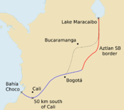 |
195 KB | weitere Korrekturmöglichkeit für neue Grenze | 3 |
| 21:22, 20. Mai 2018 | Azt-am-border-region map.svg (Datei) | 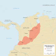 |
1,2 MB | neue Grenze | 5 |
| 21:19, 20. Mai 2018 | Azt-am-border-region relief.png (Datei) | 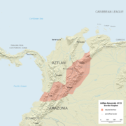 |
2,77 MB | neue Grenze | 4 |
| 21:16, 20. Mai 2018 | Azt-am-border-region sat.png (Datei) | 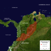 |
4,1 MB | neue Grenze | 4 |
| 21:08, 20. Mai 2018 | Azt-am-border-region map.png (Datei) | 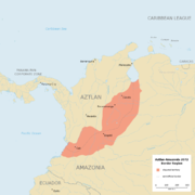 |
540 KB | neue Grenze | 4 |
| 18:43, 14. Mai 2018 | GeoPositionskarte Wien.svg (Datei) |  |
67 KB | 3 | |
| 14:07, 14. Mai 2018 | Entwurf wien dpö-gebiete.png (Datei) | 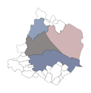 |
94 KB | 1 | |
| 12:46, 14. Mai 2018 | Weltkarte 2072 blank mollweide.svg (Datei) |  |
2,04 MB | Prince-Edward-Island, Cape Breton Island ergänzt; Asamando ergänzt; Delmarva-Halbinsel vollständig bei UCAS; Südflorida-Grenze überarbeitet; Grenze Aztlan-Amazonien überarbeitet; Balkankonfliktzone vereinfacht | 4 |
| 23:22, 13. Mai 2018 | Weltkarte 2072 blank robinson.svg (Datei) |  |
2,17 MB | Delmarva-Halbinsel vollständig bei UCAS | 5 |
| 09:29, 2. Mai 2018 | Cover Book of the Lost nicht verwendet.jpg (Datei) |  |
32 KB | {{Bildinfo |COPYRIGHT={{Copyright-Hinweis|INHABER={{copyright|catalyst}}|JAHR=2016}} |QUELLE=[http://www.gametrademagazine.com/downloads/GTM203Games.pdf Game Trade Magazine, Ausgabe 203] S. 3 |BESCHREIBUNG=Nicht final verwendetes Cover von {{Qen|botl}} }} | 1 |
| 22:36, 26. Apr. 2018 | Entwurf wien.png (Datei) | 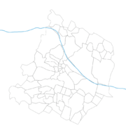 |
246 KB | 2 | |
| 21:52, 17. Apr. 2018 | Test.png (Datei) |  |
96 KB | 34 | |
| 21:22, 17. Apr. 2018 | Test.jpg (Datei) |  |
72 KB | 27 | |
| 12:27, 15. Mär. 2018 | ShxDB contributor weblink.txt (Datei) | 13 KB | 22 | ||
| 12:26, 15. Mär. 2018 | ShxDB contributor weblink hosting service.txt (Datei) | 18 KB | 21 | ||
| 12:26, 15. Mär. 2018 | ShxDB contributor.txt (Datei) | 34 KB | 36 | ||
| 12:26, 15. Mär. 2018 | ShxDB contribution illustration.txt (Datei) | 47 KB | 32 | ||
| 12:26, 15. Mär. 2018 | ShxDB contribution.txt (Datei) | 127 KB | 9 | ||
| 14:32, 14. Mär. 2018 | ShxDB illustration source.txt (Datei) | 261 KB | 40 | ||
| 12:43, 14. Mär. 2018 | ShxDB contributor referenced name.txt (Datei) | 25 KB | 10 | ||
| 20:09, 12. Mär. 2018 | ShxDB source date.txt (Datei) | 3 KB | 6 | ||
| 20:09, 12. Mär. 2018 | ShxDB source date ingame.txt (Datei) | 3 KB | 5 | ||
| 21:31, 5. Mär. 2018 | ShxDB source title.txt (Datei) | 33 KB | 13 | ||
| 21:31, 5. Mär. 2018 | ShxDB source catalog.txt (Datei) | 44 KB | 24 | ||
| 21:30, 5. Mär. 2018 | ShxDB source.txt (Datei) | 39 KB | 32 | ||
| 16:23, 3. Mär. 2018 | Overlay Pueblo alte grenzen.png (Datei) | 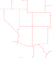 |
32 KB | {{Karteninfo |LIZENZ=[https://creativecommons.org/licenses/by-nc/4.0/ Creative Commons Attribution-NonCommercial-4.0] |AUSSCHNITT=121.6° westl. Laenge, 101.4° westl. Laenge, 27.9° noerdl. Breite, 44.6° noerdl. Breite |PROJEKTION=Equirektangular-Pro… | 1 |
| 12:39, 3. Mär. 2018 | GeoPositionskarte Pueblo Relief.jpg (Datei) | 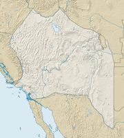 |
346 KB | 2 | |
| 19:19, 1. Mär. 2018 | Markerpunkt gruen padded.png (Datei) |  |
4 KB | {{Bildinfo |LIZENZ=Public Domain |QUELLE=[https://commons.wikimedia.org/wiki/File:SpringGreen_pog.svg Wikimedia Commons] |BEARBEITUNG=Konvertierung in png, transparentes Padding (128px) |BESCHREIBUNG="SpringGreen pog", Grüner Punkt }} [[Kategorie:!B… | 1 |
| 22:52, 4. Jan. 2018 | Map Sixth World turn of the year 2017-2018.png (Datei) | Fehler beim Erstellen des Vorschaubildes: Datei mit Abmessungen größer als 12,5 MP |
2,15 MB | 4 | |
| 23:12, 10. Jun. 2017 | Overlay GeMiTo.png (Datei) |  |
7 KB | {{Karteninfo |LIZENZ=Public Domain |BESCHREIBUNG=Overlay: GeMiTo (gehört zu GeoPositionskarte Italien.svg) }} Kategorie:!Bilder/Creative Commons Kategorie:!Bilder/Karten/Positionskarten/Overlays | 1 |
| 15:26, 10. Jun. 2017 | GeoPositionskarte Italien.svg (Datei) | 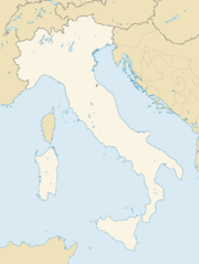 |
335 KB | {{Karteninfo |LIZENZ=[https://creativecommons.org/licenses/by-nc/4.0/ Creative Commons Attribution-NonCommercial-4.0] |AUSSCHNITT=5.7° oestl. Laenge, 19.6° oestl. Laenge, 36.1° noerdl. Breite, 47.7° noerdl. Breite |PROJEKTION=Equirektangular-Projek… | 1 |
| 18:32, 4. Mai 2017 | Karte Ägypten.jpg (Datei) | 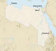 |
83 KB | 2 | |
| 23:55, 17. Feb. 2017 | ShxDB illustration weblink.txt (Datei) | 13 KB | 11 | ||
| 23:54, 17. Feb. 2017 | ShxDB index illustration person.txt (Datei) | 714 Bytes | 7 | ||
| 23:54, 17. Feb. 2017 | ShxDB illustration type.txt (Datei) | 219 Bytes | 5 | ||
| 23:51, 17. Feb. 2017 | ShxDB product type.txt (Datei) | 84 KB | 3 | ||
| 23:51, 17. Feb. 2017 | ShxDB product name.txt (Datei) | 165 KB | 4 | ||
| 23:51, 17. Feb. 2017 | ShxDB person.txt (Datei) | 17 KB | 5 |