Kategorie:!Bilder/Creative Commons
Zur Navigation springen
Zur Suche springen
Medien in der Kategorie „!Bilder/Creative Commons“
Folgende 200 Dateien sind in dieser Kategorie, von 465 insgesamt.
(vorherige Seite) (nächste Seite) ADL-Kartenvorlage fuer Modifikation.svg 1.000 × 1.294; 400 KB
 Animation Territorial Evolution of the Chinese Successor States.gif 1.000 × 1.000; 636 KB
 Animation Territorialentwicklung Mittelamerika englisch.gif 1.000 × 446; 186 KB
 Animation Territorialentwicklung Mittelamerika französisch.gif 1.000 × 446; 189 KB
 Animation Territorialentwicklung Mittelamerika.gif 1.000 × 446; 195 KB
 Animation Territorialentwicklung Nordamerika englisch.gif 1.000 × 632; 409 KB
 Animation Territorialentwicklung Nordamerika französisch.gif 1.000 × 632; 402 KB
 Animation Territorialentwicklung Nordamerika.gif 1.000 × 632; 424 KB
 Animation Territorialentwicklung Südamerika englisch.gif 1.000 × 632; 95 KB
 Animation Territorialentwicklung Südamerika französisch.gif 1.000 × 632; 94 KB
 Animation Territorialentwicklung Südamerika.gif 1.000 × 632; 99 KB
 Anpassung Kernbereich Gold- und Elfenbeinküste.png 1.000 × 762; 164 KB
 Azt-am-border-region map.png 2.000 × 2.000; 540 KB
 Azt-am-border-region map.svg 2.000 × 2.000; 1,2 MB
 Azt-am-border-region relief.png 2.000 × 2.000; 2,77 MB
 Azt-am-border-region sat.png 2.000 × 2.000; 4,1 MB
 Aztlan-Amazonien-Grenzverlauf-Korrektur.png 2.000 × 1.766; 195 KB
 Blason Paris.png 545 × 600; 141 KB
 Darstellungsvorschlag Kartenlayout.svg 1.000 × 1.000; 172 KB
 GeoPositionskarte Ägypten.svg 1.000 × 903; 307 KB
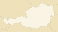
 GeoPositionskarte Österreich.svg 1.000 × 562; 157 KB
 Karte Ägypten.jpg 1.000 × 903; 83 KB
 Karte Österreich layer-basis.png 1.000 × 562; 55 KB
 Karte Österreich layer-laendergrenzen.png 1.000 × 562; 34 KB
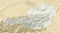 Karte Österreich layer-relief.jpg 1.000 × 562; 151 KB
 Demonstration Neueinfärbung Seen.svg 1.000 × 1.166; 920 KB
 Downtown seattle a3.jpg 1.754 × 2.480; 1,89 MB
- Fehler beim Erstellen des Vorschaubildes: Datei mit Abmessungen größer als 12,5 MPEntwurf Entwicklung von Deutschland.png 5.000 × 3.933; 1,56 MB
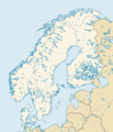
 Europakarte NEEC 2063.png 1.000 × 1.234; 312 KB
 Europakarte NEEC 2073.png 1.000 × 1.234; 324 KB
 Finlandia Vodka - Logo (Bildausschnitt aus Flaschenfoto).png 186 × 158; 44 KB
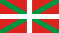 Flagge Baskenland.png 800 × 448; 22 KB
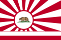 Flagge California Free State.png 810 × 540; 53 KB
 Flagge California Free State.svg 900 × 600; 597 KB
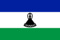 Flagge Lesotho.svg 900 × 600; 5 KB
 Flagge Panamakanalzone.jpg 800 × 533; 42 KB
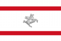 Flagge Repubblica di Toscana.png 648 × 432; 16 KB
 Fläche afghanistan 1 merc n4148.svg 1.000 × 763; 69 KB
 Fläche algerien 1 merc n2961.svg 1.000 × 911; 50 KB
 Fläche algonkian manitou council 1 merc n2785.svg 1.000 × 821; 52 KB
 Fläche amazonien 1 merc n7546.svg 1.000 × 1.097; 126 KB
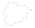 Fläche andorra 1 merc n184.svg 1.000 × 792; 4 KB
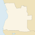
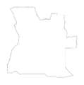 Fläche angola 1 merc n4096.svg 1.000 × 1.006; 68 KB
 Fläche Anyi 1 merc n621.svg 1.000 × 1.246; 14 KB
 Fläche arabisches kalifat 1 merc n5542.svg 1.000 × 897; 94 KB
 Fläche arabisches kalifat 2 merc n5475.svg 1.000 × 845; 90 KB
 Fläche argentinien 1 merc n9298.svg 1.000 × 1.988; 158 KB
 Fläche asante nation 1 merc n2185.svg 1.000 × 1.086; 53 KB
 Fläche azania 1 merc n4650.svg 1.000 × 942; 77 KB
 Fläche aztlan 1 merc n5664.svg 1.000 × 713; 97 KB
 Fläche baatonum 1 merc n517.svg 1.000 × 795; 10 KB
 Fläche beijing 1 merc n1385.svg 1.000 × 1.012; 24 KB
 Fläche Benin 1 merc n2649.svg 1.000 × 1.150; 61 KB
 Fläche bolivien 1 merc n3821.svg 1.000 × 1.128; 64 KB
 Fläche brüssel 1 merc n91.svg 1.000 × 1.318; 4 KB
 Fläche california free state 1 merc n3614.svg 1.000 × 1.300; 68 KB
 Fläche caracas-venezuela 1 merc n2157.svg 1.000 × 665; 36 KB
 Fläche chile 1 merc n37922.svg 1.000 × 5.431; 657 KB
 Fläche chinesische küstenprovinzen 1 merc n14807.svg 1.000 × 1.773; 250 KB
 Fläche confederation of american states 1 merc n7967.svg 1.000 × 574; 133 KB
 Fläche Ecuador 1 merc n5540.svg 1.000 × 1.103; 92 KB
 Fläche estland 1 merc n5753.svg 1.000 × 860; 95 KB
 Fläche euskal herria 1 merc n2318.svg 1.000 × 818; 41 KB
 Fläche frankreich 1 merc n8175.svg 1.000 × 981; 138 KB
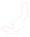
 Fläche französisch-guayana 1 merc n2334.svg 1.000 × 1.227; 40 KB
 Fläche freistaat königsberg 1 merc n3711.svg 1.000 × 541; 61 KB
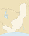
 Fläche gold- und elfenbeinküste 1 merc n6951.svg 1.000 × 687; 119 KB
 Fläche italienische konföderation 1 merc n6563.svg 1.000 × 1.047; 110 KB
 Fläche karibische liga 1 merc n8131.svg 1.000 × 689; 134 KB
 Fläche kenia 1 merc n3319.svg 1.000 × 1.292; 58 KB
 Fläche kongo 1 merc n6400.svg 1.000 × 1.293; 110 KB
 Fläche kongo dmz 1 merc n4636.svg 1.000 × 1.785; 79 KB
 Fläche korea 1 merc n16399.svg 1.000 × 1.717; 279 KB
 Fläche lettland 1 merc n4459.svg 1.000 × 607; 74 KB
 Fläche liberia 1 merc n4097.svg 1.000 × 1.019; 68 KB
 Fläche litauen 1 merc n3920.svg 1.000 × 770; 65 KB
 Fläche luxemburg 1 merc n485.svg 1.000 × 1.445; 9 KB
 Fläche mali-faso 1 merc n3654.svg 1.000 × 783; 62 KB
 Fläche mandschurei 1 merc n6088.svg 1.000 × 986; 102 KB
 Fläche marokko 1 merc n3986.svg 1.000 × 1.070; 67 KB
 Fläche Mauretanien 1 merc n2181.svg 1.000 × 905; 38 KB
 Fläche mongolei 1 merc n3758.svg 1.000 × 651; 65 KB
 Fläche nigeria 1 merc n5830.svg 1.000 × 804; 99 KB
 Fläche ningxia 1 merc n4475.svg 1.000 × 1.539; 76 KB
 Fläche paraguay 1 merc n3097.svg 1.000 × 1.076; 52 KB
 Fläche peru 1 merc n7582.svg 1.000 × 1.463; 127 KB
 Fläche portugal 1 merc n12471.svg 1.000 × 2.020; 212 KB
 Fläche pueblo corporate council 1 merc n1233.svg 1.000 × 824; 39 KB
 Fläche quebec 1 merc n18493.svg 1.000 × 1.267; 306 KB
 Fläche republik china 1 merc n5614.svg 1.000 × 1.326; 94 KB
 Fläche salish-shidhe council 1 merc n8023.svg 1.000 × 1.101; 141 KB
 Fläche schweiz 1 merc n1854.svg 1.000 × 626; 32 KB
 Fläche sekondi 1 merc n1118.svg 1.000 × 777; 20 KB
 Fläche shaanxi 1 merc n7176.svg.svg 1.000 × 1.316; 122 KB
 Fläche sheba 1 merc n3172.svg 1.000 × 916; 54 KB
 Fläche sioux nation 1 merc n859.svg 1.000 × 1.497; 20 KB
 Fläche slowakei 1 merc n2649.svg 1.000 × 493; 44 KB
 Fläche spanien 1 merc n7632.svg 1.000 × 803; 126 KB
 Fläche tir na nog 1 merc n21379.svg 1.000 × 1.306; 356 KB
 Fläche tir tairngire 1 merc n2920.svg 1.000 × 955; 49 KB
 Fläche transkaukasische föderation 1 merc n3247.svg 1.000 × 661; 54 KB
 Fläche tsimshian 1 merc n6907.svg 1.000 × 771; 116 KB
 Fläche tunesien 1 merc n7690.svg 1.000 × 2.096; 129 KB
 Fläche ukraine 1 merc n6766.svg 1.000 × 666; 111 KB
 Fläche ungarn 1 merc n2501.svg 1.000 × 612; 42 KB
 Fläche united canadian and american states 1 merc n4244.svg 1.000 × 318; 75 KB
 Fläche weißrussland 1 merc n4941.svg 1.000 × 861; 82 KB
 Fläche yucatan 1 merc n5964.svg 1.000 × 702; 98 KB
 Fläche ägypten 1 merc n3510.svg 1.000 × 916; 60 KB
 Fläche äthiomalische territorien 1 merc n3450.svg 1.000 × 792; 59 KB
 Fläche österreich 1 merc n3427.svg 1.000 × 513; 57 KB
 Frontier.jpg 149 × 201; 8 KB
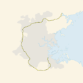
 GeoPositionskarte ADL.svg 1.000 × 1.256; 359 KB
 GeoPositionskarte Afghanistan.svg 1.000 × 808; 76 KB
 GeoPositionskarte Algerien.svg 1.000 × 907; 192 KB
 GeoPositionskarte Algonkian-Manitou.svg 1.000 × 835; 748 KB
 GeoPositionskarte Amazonien.svg 1.000 × 1.055; 613 KB
 GeoPositionskarte Angola.svg 1.000 × 1.008; 65 KB
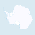 GeoPositionskarte Antarktis.svg 1.000 × 1.000; 217 KB
 GeoPositionskarte Anyi.svg 1.000 × 1.214; 56 KB
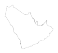
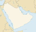 GeoPositionskarte Arabien.svg 1.000 × 892; 295 KB
 GeoPositionskarte Asamando.svg 1.000 × 1.133; 35 KB
 GeoPositionskarte Asante.svg 1.000 × 1.006; 104 KB
 GeoPositionskarte Athabaska.svg 1.000 × 447; 360 KB
 GeoPositionskarte Äthiomalia.svg 1.000 × 794; 117 KB
 GeoPositionskarte Australien.svg 1.000 × 1.130; 719 KB
 GeoPositionskarte Azania.svg 1.000 × 941; 190 KB
 GeoPositionskarte Aztlan.svg 1.000 × 705; 328 KB
 GeoPositionskarte Baatonum.svg 1.000 × 825; 21 KB
 GeoPositionskarte Bakongo.svg 1.000 × 1.241; 470 KB
 GeoPositionskarte Bali und Lombok.svg 1.000 × 496; 50 KB
 GeoPositionskarte Balkan-Konfliktzone.svg 1.000 × 894; 205 KB
 GeoPositionskarte Bangla.svg 1.000 × 977; 436 KB
 GeoPositionskarte Baule.svg 1.000 × 786; 39 KB
 GeoPositionskarte Beijing.svg 1.000 × 1.039; 50 KB
 GeoPositionskarte Benin.svg 1.000 × 1.140; 118 KB
 GeoPositionskarte Berlin.svg 1.000 × 780; 146 KB
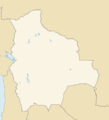 GeoPositionskarte Bolivien.svg 1.000 × 1.104; 78 KB
 GeoPositionskarte Boston.svg 1.000 × 943; 43 KB
 GeoPositionskarte Brüssel.svg 1.000 × 1.259; 5 KB
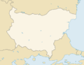 GeoPositionskarte Bulgarien.svg 1.000 × 771; 93 KB
 GeoPositionskarte CAS.svg 1.000 × 617; 421 KB
 GeoPositionskarte Dayak-Rat.svg 1.000 × 864; 630 KB
 GeoPositionskarte Denver.svg 1.000 × 1.612; 43 KB
 GeoPositionskarte Ecuador.svg 1.000 × 1.103; 153 KB
 GeoPositionskarte Estland.svg 1.000 × 663; 205 KB
 GeoPositionskarte Euskal Herria.svg 1.000 × 866; 56 KB
 GeoPositionskarte FDC.svg 1.000 × 1.159; 123 KB
 GeoPositionskarte Frankreich.svg 1.000 × 936; 365 KB
 GeoPositionskarte Französisch-Guayana.svg 1.000 × 1.217; 48 KB
 GeoPositionskarte Gansu.svg 1.000 × 854; 179 KB
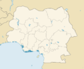
 GeoPositionskarte Gold- und Elfenbeinküste.svg 1.000 × 701; 196 KB
 GeoPositionskarte Griechenland.svg 1.000 × 977; 310 KB
 GeoPositionskarte Großbritannien.svg 1.000 × 1.707; 642 KB
 GeoPositionskarte Guangxi.svg 1.000 × 756; 191 KB
 GeoPositionskarte Hainan.svg 1.000 × 893; 90 KB
 GeoPositionskarte Heilige Berge Daoismus.svg 1.000 × 1.000; 456 KB
 GeoPositionskarte Henan.svg 1.000 × 876; 336 KB
 GeoPositionskarte Hongkong.svg 1.000 × 809; 307 KB
 GeoPositionskarte Indien.svg 1.000 × 1.324; 673 KB
 GeoPositionskarte Irak.svg 1.000 × 993; 73 KB
 GeoPositionskarte Iran.svg 1.000 × 936; 256 KB
 GeoPositionskarte Israel.svg 1.000 × 1.739; 202 KB
 GeoPositionskarte Italien.svg 1.000 × 1.326; 335 KB
 GeoPositionskarte Jakutien.svg 1.000 × 691; 372 KB
 GeoPositionskarte Japan.svg 1.000 × 971; 470 KB
 GeoPositionskarte Java.svg 1.000 × 386; 84 KB
 GeoPositionskarte Kachin-Staat.svg 1.000 × 960; 63 KB
 GeoPositionskarte Kalifornien.svg 1.000 × 1.252; 174 KB
 GeoPositionskarte Kambodscha.svg 1.000 × 839; 143 KB
 GeoPositionskarte Kanton.svg 1.000 × 975; 350 KB
 GeoPositionskarte Karibische Liga.svg 1.000 × 754; 316 KB
 GeoPositionskarte Kenia.svg 1.000 × 1.295; 162 KB
 GeoPositionskarte Khalistan.svg 1.000 × 895; 60 KB
 GeoPositionskarte Kongo DMZ.svg 1.000 × 1.675; 133 KB
 GeoPositionskarte Korea.svg 1.000 × 1.803; 553 KB
 GeoPositionskarte Korsika.svg 1.000 × 1.914; 150 KB
 GeoPositionskarte Kurdistan.svg 1.000 × 953; 155 KB
 GeoPositionskarte Königreich Hawaii.svg 1.000 × 685; 37 KB
 GeoPositionskarte Königsberg.svg 1.000 × 604; 35 KB
 GeoPositionskarte Küstenprovinzen.svg 1.000 × 1.716; 392 KB
 GeoPositionskarte Laos.svg 1.000 × 1.157; 217 KB
 GeoPositionskarte Lettland.svg 1.000 × 589; 66 KB
 GeoPositionskarte Liberia.svg 1.000 × 1.024; 64 KB
 GeoPositionskarte Litauen.svg 1.000 × 783; 79 KB
 GeoPositionskarte Madagaskar.svg 1.000 × 1.756; 223 KB
 GeoPositionskarte Malaysia.svg 1.000 × 1.246; 449 KB
 GeoPositionskarte Mali-Faso.svg 1.000 × 788; 111 KB
 GeoPositionskarte Mandschurei.svg 1.000 × 928; 320 KB
 GeoPositionskarte Marokko.svg 1.000 × 1.062; 229 KB
 GeoPositionskarte Mauretanien.svg 1.000 × 919; 96 KB
 GeoPositionskarte Mongolei.svg 1.000 × 668; 258 KB
 GeoPositionskarte Myanmar.svg 1.000 × 1.850; 373 KB
 GeoPositionskarte NEMAQZ.svg 1.000 × 1.000; 174 KB
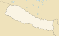 GeoPositionskarte Nepal.svg 1.000 × 608; 105 KB
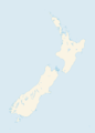 GeoPositionskarte Neuseeland.svg 1.000 × 1.390; 305 KB
 GeoPositionskarte Nigeria.svg 1.000 × 824; 268 KB
 GeoPositionskarte Ningxia.svg 1.000 × 1.497; 157 KB
 GeoPositionskarte Nordamerika 2050-2061.svg 1.000 × 726; 819 KB
 GeoPositionskarte Nordamerika.svg 1.000 × 726; 767 KB


.png)