Von Loki hochgeladene Dateien
Zur Navigation springen
Zur Suche springen
Diese Spezialseite listet alle hochgeladenen Dateien auf.
| Datum | Name | Vorschaubild | Größe | Beschreibung | Versionen |
|---|---|---|---|---|---|
| 11:30, 2. Mär. 2016 | Cover Never Deal With A Dragon Ebook 2010.jpg (Datei) |  |
64 KB | {{Bildinfo |COPYRIGHT={{Copyright-Hinweis|INHABER={{copyright|catalyst}}|JAHR=2010}} |BESCHREIBUNG=Cover: Never Deal with a Dragon (2010) }} Kategorie:!Bilder/Romane/Englisch | 1 |
| 21:20, 11. Jan. 2016 | Karte TSW Africa.gif (Datei) |  |
57 KB | 1 | |
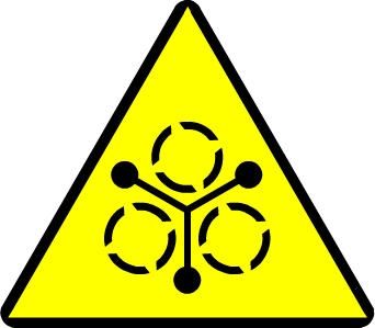
| 16:39, 5. Jan. 2016 | Gefahrensymbol Nanopartikel 2.png (Datei) |  |
5 KB | {{Bildinfo |LIZENZ= |URHEBER=Finarfin (Nachbau) |QUELLE={{QDE|gs}} S. 219 |BESCHREIBUNG=Gefahrensymbol Nanopartikel. Erzeugt mit [http://www.heromachine.com/ heromachine]. }} Kategorie:!Bilder/Symbole | 1 |
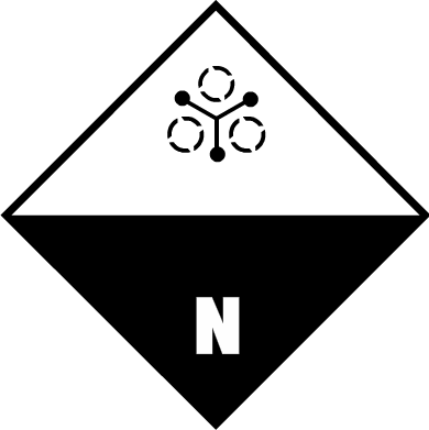
| 16:39, 5. Jan. 2016 | Gefahrensymbol Nanopartikel 1.png (Datei) |  |
5 KB | {{Bildinfo |LIZENZ= |URHEBER=Finarfin (Nachbau) |QUELLE={{QDE|gs}} S. 219 |BESCHREIBUNG=Warnzeichen Nanopartikel. Erzeugt mit [http://www.heromachine.com/ heromachine]. }} Kategorie:!Bilder/Symbole | 1 |
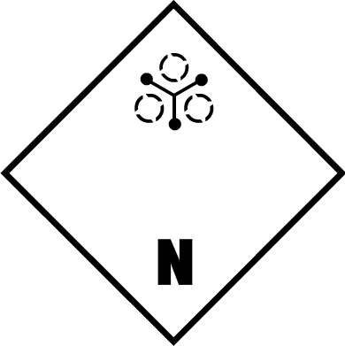
| 16:36, 5. Jan. 2016 | Warnzeichen Nanopartikel.png (Datei) |  |
8 KB | {{Bildinfo |LIZENZ= |URHEBER=Finarfin (Nachbau) |QUELLE={{QDE|gs}} S. 219 |BESCHREIBUNG=Warnzeichen Nanopartikel. Erzeugt mit [http://www.heromachine.com/ heromachine]. }} Kategorie:!Bilder/Symbole | 1 |
| 15:48, 13. Sep. 2015 | ShxDB type.txt (Datei) | 3 KB | {| class="infobox" style="width:100%;" | style="width:10%" | '''columns''' | <tt>id_type <nowiki>|</nowiki> language_code <nowiki>|</nowiki> name</tt> |} | 1 | |
| 23:43, 25. Aug. 2015 | GeoPositionskarte NEMAQZ.svg (Datei) |  |
174 KB | 2 | |
| 22:09, 26. Mai 2015 | Overlay Boston MCZ.png (Datei) |  |
14 KB | {{Karteninfo |LIZENZ=Public Domain |BESCHREIBUNG=Overlay: Boston - MCZ (gehört zu GeoPositionskarte Boston.svg) }} Kategorie:!Bilder/Public Domain Kategorie:!Bilder/Karten/Positionskarten/Overlays | 1 |
| 17:10, 24. Mai 2015 | GeoPositionskarte Boston.svg (Datei) |  |
43 KB | 3 | |
| 21:15, 22. Mai 2015 | Overlay ADL Spessart Umriss.png (Datei) |  |
7 KB | {{Karteninfo |LIZENZ=Public Domain |BESCHREIBUNG=Overlay: ADL - Spessart (gehört zu GeoPositionskarte ADL.svg) }} Kategorie:!Bilder/Public Domain Kategorie:!Bilder/Karten/Positionskarten/Overlays | 1 |
| 11:44, 19. Mai 2015 | Shadowtalk Pfeil unten.png (Datei) |  |
177 Bytes | 2 | |
| 23:36, 14. Mai 2015 | Cover JA RC SR4.jpg (Datei) |  |
22 KB | 2 | |
| 16:06, 18. Apr. 2015 | Signatur Thomas Baxa.png (Datei) |  |
5 KB | {{Bildinfo |COPYRIGHT=? |BESCHREIBUNG=Signatur {{Beitrag|Thomas Baxa}} (1993) }} | 1 |
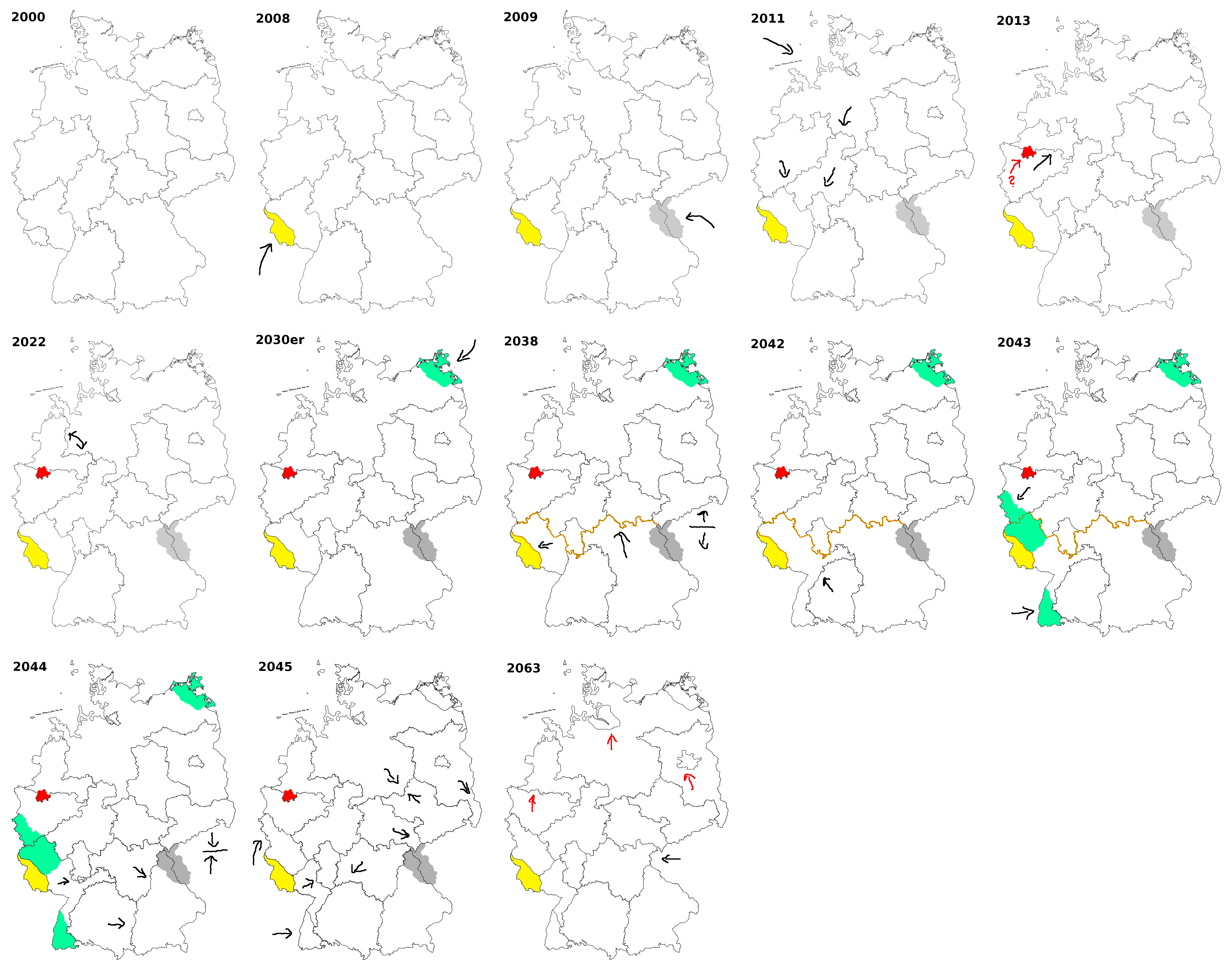
| 20:41, 19. Feb. 2015 | Entwurf Entwicklung von Deutschland.png (Datei) | Fehler beim Erstellen des Vorschaubildes: Datei mit Abmessungen größer als 12,5 MP |
1,56 MB | 1 | |
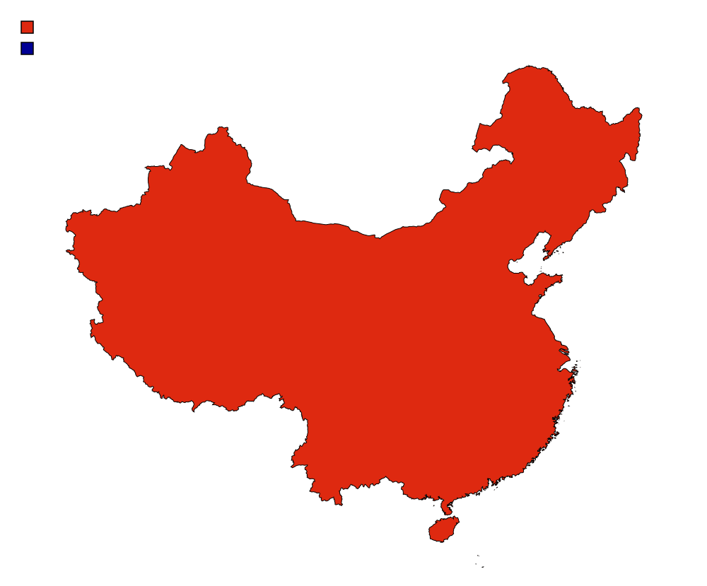
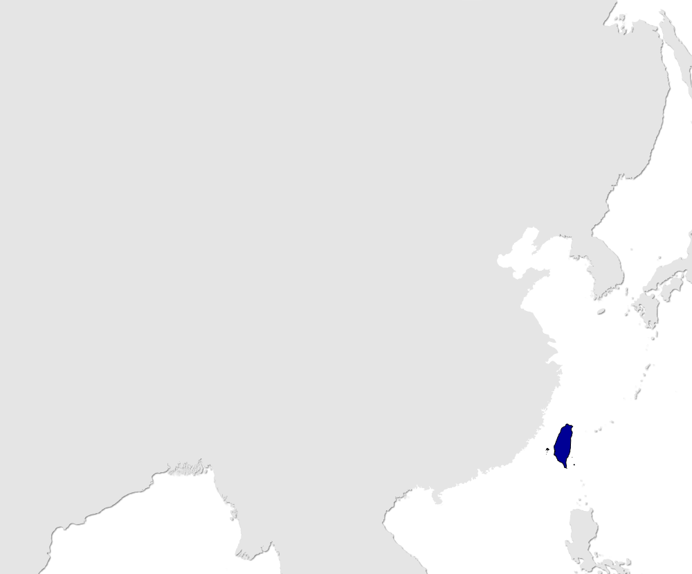
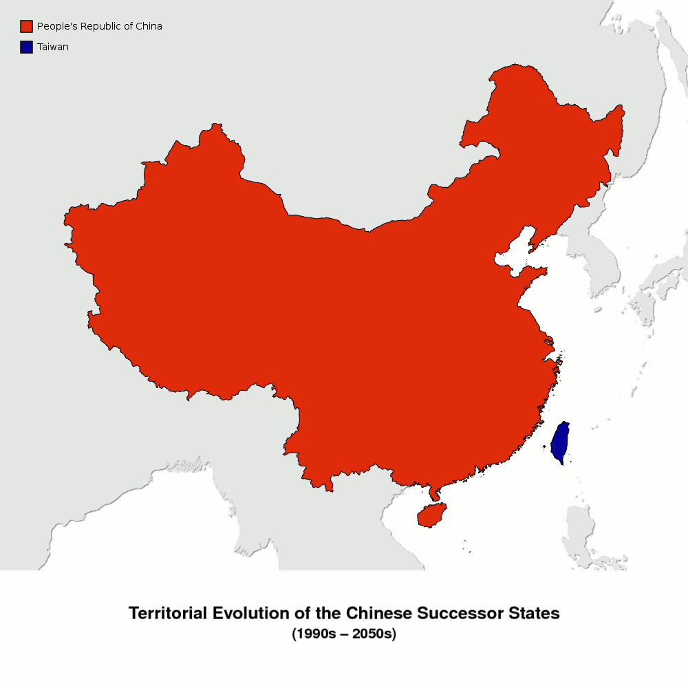
| 16:47, 16. Feb. 2015 | Karte Territorialentwicklung China layer-1320.png (Datei) |  |
97 KB | {{Bildinfo |LIZENZ=[http://creativecommons.org/licenses/by-nc/4.0/ Creative Commons Attribution-NonCommercial 4.0] |QUELLE=Global Administrative Areas [http://www.gadm.org]<br/>Shadowrun-Karten als Referenz |BESCHREIBUNG=Layer 1320 (2018); Equidistant … | 1 |
| 16:43, 16. Feb. 2015 | Karte Territorialentwicklung China layer-1000.png (Datei) |  |
52 KB | 2 | |
| 16:12, 16. Feb. 2015 | Karte Territorialentwicklung China layer-basis.png (Datei) |  |
52 KB | {{Bildinfo |LIZENZ=[http://creativecommons.org/licenses/by-nc/4.0/ Creative Commons Attribution-NonCommercial 4.0] |QUELLE=Global Administrative Areas [http://www.gadm.org]<br/>Shadowrun-Karten als Referenz |BESCHREIBUNG=Layer Basis; Equidistant Conic … | 1 |
| 00:08, 16. Feb. 2015 | Animation Territorial Evolution of the Chinese Successor States.gif (Datei) |  |
636 KB | -1 second per slide | 2 |
| 11:56, 18. Nov. 2014 | Weltkarte Overlay Bayard.png (Datei) |  |
2 KB | {{Karteninfo |LIZENZ=[http://creativecommons.org/licenses/by-nc/3.0/ Creative Commons Attribution-Noncommercial Unported 3.0] |AUSSCHNITT=180° westl. Laenge, 180° oestl. Laenge, 90° suedl. Breite, 90° noerdl. Breite |PROJEKTION=Robinson-Projektion … | 1 |
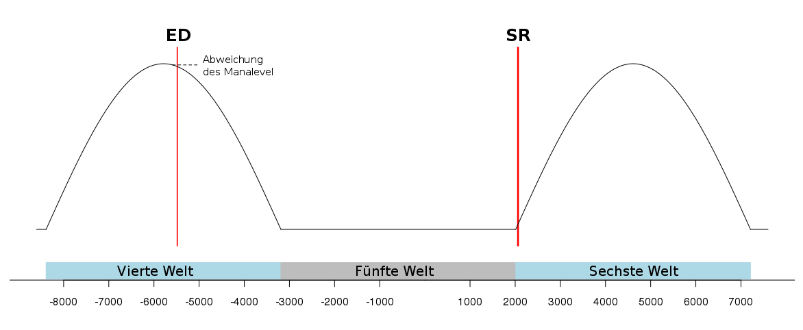
| 22:57, 27. Okt. 2014 | Graphik Earthdawn Shadowrun Zeitstrahl Mananiveau.png (Datei) |  |
21 KB | 3 | |
| 22:57, 27. Okt. 2014 | Graphik Earthdawn Shadowrun Zeitstrahl Mananiveau 2.png (Datei) |  |
19 KB | 4 | |
| 11:03, 7. Okt. 2014 | Grey Cover.jpg (Datei) |  |
283 Bytes | {{Bildinfo |LIZENZ={{PD-Schöpfungshöhe}} |BESCHREIBUNG=Dummy Cover }} Kategorie:!Bilder/Public Domain | 1 |
| 10:55, 7. Okt. 2014 | Grey.jpg (Datei) |  |
283 Bytes | {{Bildinfo |LIZENZ={{PD-Schöpfungshöhe}} |BESCHREIBUNG=einzelner grauer Pixel }} Kategorie:!Bilder/Public Domain | 1 |
| 21:26, 29. Sep. 2014 | GeoPositionskarte Frankreich.svg (Datei) |  |
365 KB | 8 | |
| 09:29, 28. Aug. 2014 | ShxDB shadow matrix shadowtalk source.txt (Datei) | 352 KB | 1 | ||
| 09:26, 28. Aug. 2014 | ShxDB shadow matrix user.txt (Datei) | 150 KB | 1 | ||
| 19:08, 11. Aug. 2014 | GeoPositionskarte UCAS.svg (Datei) |  |
584 KB | 4 | |
| 20:46, 6. Aug. 2014 | CC BY-NC.png (Datei) |  |
9 KB | 2 | |
| 20:22, 6. Aug. 2014 | CC BY.png (Datei) |  |
12 KB | {{Bildinfo |LIZENZ=Verwendung unter [https://creativecommons.org/policies Creative Commons Trademark policy] |QUELLE=https://creativecommons.org/about/downloads |BESCHREIBUNG=Logo der Lizenz "CC BY" für Vorlage:CC }} | 1 |
| 19:57, 6. Aug. 2014 | CC BY-NC-SA.png (Datei) |  |
22 KB | {{Bildinfo |LIZENZ=Verwendung unter [https://creativecommons.org/policies Creative Commons Trademark policy] |QUELLE=https://creativecommons.org/about/downloads |BESCHREIBUNG=Logo der Lizenz "CC BY-NC-SA" für Vorlage:CC }} | 1 |
| 11:13, 4. Aug. 2014 | Overlay Frankreich VSA.png (Datei) |  |
5 KB | {{Karteninfo |LIZENZ=Public Domain |QUELLE=Shadowrun-Karten (in Form übertragener Geodaten) |BESCHREIBUNG=Overlay: Vulkanische Sicherheitszone Auvergne (gehört zu GeoPositionskarte Frankreich.svg) }} [[Kat… | 1 |
| 09:39, 28. Jul. 2014 | GeoPositionskarte Königreich Hawaii.svg (Datei) |  |
37 KB | 3 | |
| 21:39, 17. Jul. 2014 | Oslo Vikings Logo.png (Datei) | 525 KB | Hintergrund transparent, crop | 2 | |
| 21:39, 17. Jul. 2014 | Mangy Black Cats Logo ohne Comic Sans 4.png (Datei) | 61 KB | Hintergrund transparent | 2 | |
| 15:03, 4. Jul. 2014 | Cover en sg sr5 CAT27003.jpg (Datei) |  |
28 KB | {{Bildinfo |COPYRIGHT={{Copyright-Hinweis|INHABER={{copyright|catalyst}}|JAHR=2014}} |URHEBER=? |QUELLE=http://www.shadowruntabletop.com/2014/06/street-grimoire-pdfprint-preorder-available/ |BESCHREIBUNG=Cover: {{Qen|sg}} }} Kategorie:!Bilder/Quellen | 1 |
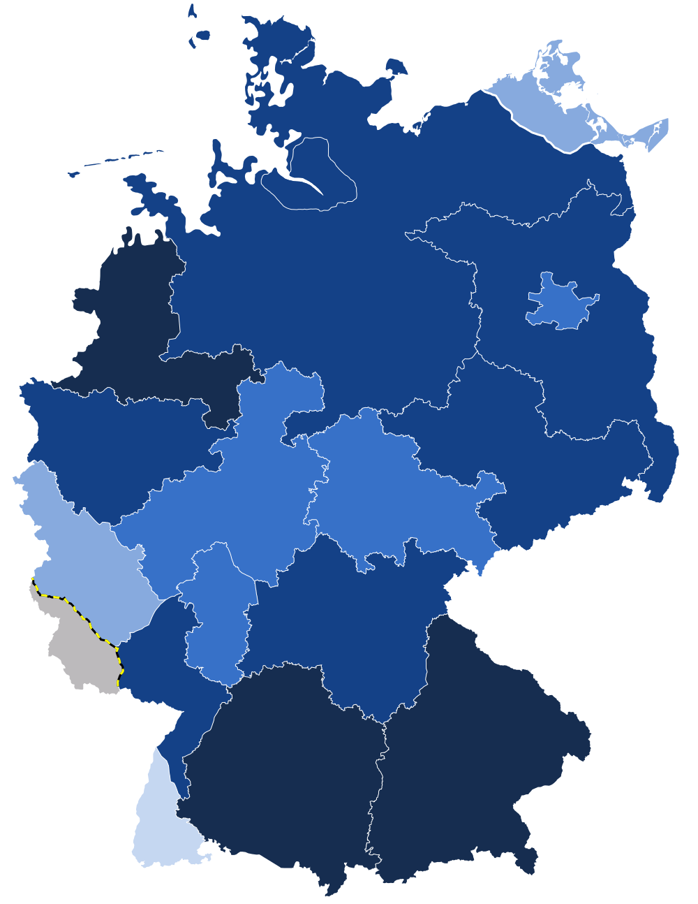
| 13:06, 18. Jun. 2014 | Karte Statistiken ADL layer-bevoelkerungsdichte.png (Datei) |  |
182 KB | {{Karteninfo |LIZENZ=[http://creativecommons.org/licenses/by-nc-sa/3.0/ Creative Commons Attribution-Noncommercial-Share Alike 3.0] |AUSSCHNITT=5.7° oestl. Laenge, 15.3° oestl. Laenge, 47.2° noerdl. Breite, 55° noerdl. Breite |PROJEKTION=Mercator-P… | 1 |
| 12:58, 18. Jun. 2014 | Karte Statistiken ADL layer-konzernangehoerigkeit.png (Datei) |  |
165 KB | {{Karteninfo |LIZENZ=[http://creativecommons.org/licenses/by-nc-sa/3.0/ Creative Commons Attribution-Noncommercial-Share Alike 3.0] |AUSSCHNITT=5.7° oestl. Laenge, 15.3° oestl. Laenge, 47.2° noerdl. Breite, 55° noerdl. Breite |PROJEKTION=Mercator-P… | 1 |
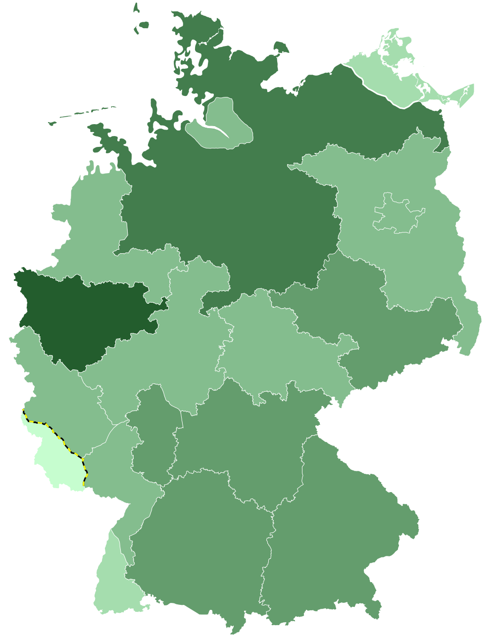
| 12:44, 18. Jun. 2014 | Karte Statistiken ADL layer-armut.png (Datei) |  |
162 KB | {{Karteninfo |LIZENZ=[http://creativecommons.org/licenses/by-nc-sa/3.0/ Creative Commons Attribution-Noncommercial-Share Alike 3.0] |AUSSCHNITT=5.7° oestl. Laenge, 15.3° oestl. Laenge, 47.2° noerdl. Breite, 55° noerdl. Breite |PROJEKTION=Mercator-P… | 1 |
| 12:32, 18. Jun. 2014 | Karte Statistiken ADL layer-bev-mehrheitsmetatyp.png (Datei) |  |
145 KB | {{Karteninfo |LIZENZ=[http://creativecommons.org/licenses/by-nc-sa/3.0/ Creative Commons Attribution-Noncommercial-Share Alike 3.0] |AUSSCHNITT=5.7° oestl. Laenge, 15.3° oestl. Laenge, 47.2° noerdl. Breite, 55° noerdl. Breite |PROJEKTION=Mercator-P… | 1 |
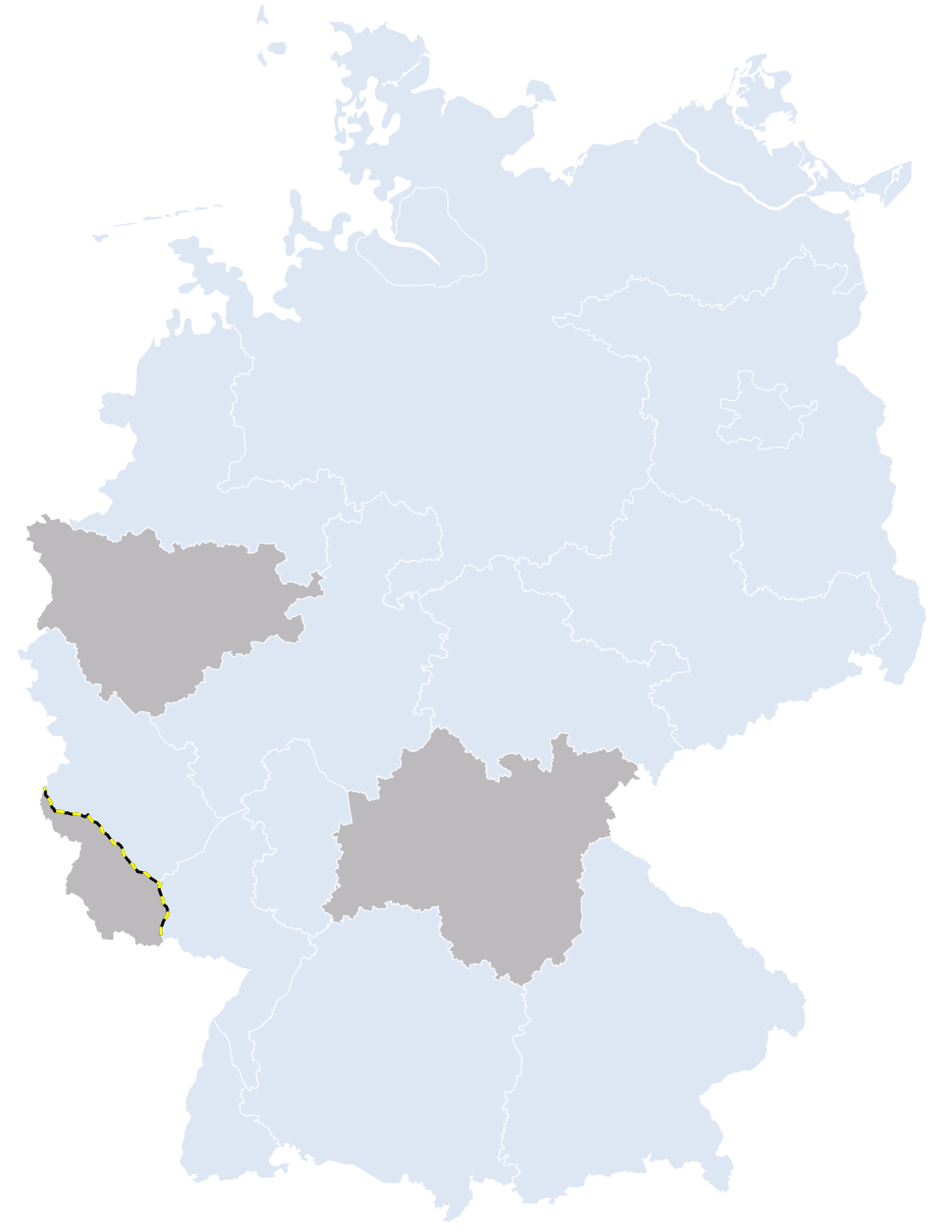
| 12:22, 18. Jun. 2014 | Karte Statistiken ADL layer-bev-zwerg.png (Datei) |  |
165 KB | {{Karteninfo |LIZENZ=[http://creativecommons.org/licenses/by-nc-sa/3.0/ Creative Commons Attribution-Noncommercial-Share Alike 3.0] |AUSSCHNITT=5.7° oestl. Laenge, 15.3° oestl. Laenge, 47.2° noerdl. Breite, 55° noerdl. Breite |PROJEKTION=Mercator-P… | 1 |
| 21:52, 17. Jun. 2014 | Statistiken Allianz Deutscher Länder.txt (Datei) | 2 KB | 2 | ||
| 14:38, 12. Jun. 2014 | Karte Statistiken ADL layer-bildung-studium.png (Datei) |  |
180 KB | {{Karteninfo |LIZENZ=[http://creativecommons.org/licenses/by-nc-sa/3.0/ Creative Commons Attribution-Noncommercial-Share Alike 3.0] |AUSSCHNITT=5.7° oestl. Laenge, 15.3° oestl. Laenge, 47.2° noerdl. Breite, 55° noerdl. Breite |PROJEKTION=Mercator-P… | 1 |
| 14:37, 12. Jun. 2014 | Karte Statistiken ADL layer-bildung-abitur.png (Datei) |  |
187 KB | {{Karteninfo |LIZENZ=[http://creativecommons.org/licenses/by-nc-sa/3.0/ Creative Commons Attribution-Noncommercial-Share Alike 3.0] |AUSSCHNITT=5.7° oestl. Laenge, 15.3° oestl. Laenge, 47.2° noerdl. Breite, 55° noerdl. Breite |PROJEKTION=Mercator-P… | 1 |
| 23:10, 11. Jun. 2014 | Karte Statistiken ADL layer-einkommen.png (Datei) |  |
165 KB | {{Karteninfo |LIZENZ=[http://creativecommons.org/licenses/by-nc-sa/3.0/ Creative Commons Attribution-Noncommercial-Share Alike 3.0] |AUSSCHNITT=5.7° oestl. Laenge, 15.3° oestl. Laenge, 47.2° noerdl. Breite, 55° noerdl. Breite |PROJEKTION=Mercator-P… | 1 |
| 23:06, 11. Jun. 2014 | Karte Statistiken ADL layer-bev-troll.png (Datei) |  |
164 KB | {{Karteninfo |LIZENZ=[http://creativecommons.org/licenses/by-nc-sa/3.0/ Creative Commons Attribution-Noncommercial-Share Alike 3.0] |AUSSCHNITT=5.7° oestl. Laenge, 15.3° oestl. Laenge, 47.2° noerdl. Breite, 55° noerdl. Breite |PROJEKTION=Mercator-P… | 1 |
| 23:03, 11. Jun. 2014 | Karte Statistiken ADL layer-bev-ork.png (Datei) |  |
168 KB | {{Karteninfo |LIZENZ=[http://creativecommons.org/licenses/by-nc-sa/3.0/ Creative Commons Attribution-Noncommercial-Share Alike 3.0] |AUSSCHNITT=5.7° oestl. Laenge, 15.3° oestl. Laenge, 47.2° noerdl. Breite, 55° noerdl. Breite |PROJEKTION=Mercator-P… | 1 |
| 22:50, 11. Jun. 2014 | Karte Statistiken ADL layer-bev-mensch.png (Datei) |  |
190 KB | {{Karteninfo |LIZENZ=[http://creativecommons.org/licenses/by-nc-sa/3.0/ Creative Commons Attribution-Noncommercial-Share Alike 3.0] |AUSSCHNITT=5.7° oestl. Laenge, 15.3° oestl. Laenge, 47.2° noerdl. Breite, 55° noerdl. Breite |PROJEKTION=Mercator-P… | 1 |
| 22:46, 11. Jun. 2014 | Karte Statistiken ADL layer-bev-elf.png (Datei) |  |
167 KB | {{Karteninfo |LIZENZ=[http://creativecommons.org/licenses/by-nc-sa/3.0/ Creative Commons Attribution-Noncommercial-Share Alike 3.0] |AUSSCHNITT=5.7° oestl. Laenge, 15.3° oestl. Laenge, 47.2° noerdl. Breite, 55° noerdl. Breite |PROJEKTION=Mercator-P… | 1 |
| 22:21, 11. Jun. 2014 | Karte Statistiken ADL layer-bevoelkerung.png (Datei) |  |
190 KB | {{Karteninfo |LIZENZ=[http://creativecommons.org/licenses/by-nc-sa/3.0/ Creative Commons Attribution-Noncommercial-Share Alike 3.0] |AUSSCHNITT=5.7° oestl. Laenge, 15.3° oestl. Laenge, 47.2° noerdl. Breite, 55° noerdl. Breite |PROJEKTION=Mercator-P… | 1 |
| 22:18, 11. Jun. 2014 | Karte Statistiken ADL layer-bev-andere.png (Datei) |  |
163 KB | {{Karteninfo |LIZENZ=[http://creativecommons.org/licenses/by-nc-sa/3.0/ Creative Commons Attribution-Noncommercial-Share Alike 3.0] |AUSSCHNITT=5.7° oestl. Laenge, 15.3° oestl. Laenge, 47.2° noerdl. Breite, 55° noerdl. Breite |PROJEKTION=Mercator-P… | 1 |