Datei:Animation Territorial Evolution of the Chinese Successor States.gif
Zur Navigation springen
Zur Suche springen


Größe dieser Vorschau: 600 × 600 Pixel. Weitere Auflösung: 1.000 × 1.000 Pixel.
Originaldatei (1.000 × 1.000 Pixel, Dateigröße: 636 KB, MIME-Typ: image/gif, Endlosschleife, 32 Bilder, 5 min 31 s)
Hinweis: Aufgrund technischer Beschränkungen werden Vorschaubilder hochauflösender GIF-Dateien wie dieser nicht animiert.
| Übersicht | |
|---|---|
| Lizenz | Creative Commons Attribution-NonCommercial 4.0 |
| Quelle | Global Administrative Areas [1] Shadowrun maps as reference |
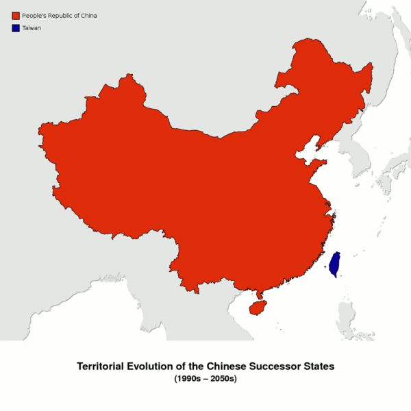
| Beschreibung | Animation: Territorial Evolution of the Chinese Successor States (1990s-2050s); China in Equidistant Conic Projection with Central meridian: 104° E, Central parallel: 36° N, Standard parallels: 30° N and 42° N |
References
- 1997
- Hong Kong, Shadows of Asia p. 22
- 1999
- Macao, Shadows of Asia p. 27
- 2006
- Greater Canton, Shadows of Asia p. 24
- 2011
- Lagu-lagu, Cyberpirates! p. 62, 64
- Tibet, Shadows of Asia p. 24
- 2013
- Xinjiang, Shadows of Asia p. 24, 202
- 2015
- Hong Kong, Runner Havens p. 6; Shadows of Asia p. 22, 24
- 2017
- earthquake, Shadows of Asia p. 22, 24
- 2018
- secession wave, Shadows of Asia p. 22, 24
- Beijing coup, Shadows of Asia p. 22, 24
- Hainan withdrawal, State of the Art: 2064 p. 28
- 2019
- Henan, Shadows of Asia p. 42
- Yunnan, Shadows of Asia p. 148
- 2024
- Yunnan, Shadows of Asia p. 148
- 2019-2027
- Republican Civil War, Shadows of Asia p. 22, 24, 42
- annexation of the Huang He valley, Shadows of Asia p.48
- 2034
- Vietnam, Shadows of Asia p. 149
- 2040
- nationalists' election wins, Shadows of Asia p. 22
- 2041-44
- Nationalist War, Shadows of Asia p. 22, 24
- 2041
- Commonwealth of Turkestan, Shadows of Asia p. 202
- 2047
- Sichuan expansion, Dragons of the Sixth World p. 118; Shadows of Asia p.24
Dateiversionen
Klicke auf einen Zeitpunkt, um diese Version zu laden.
| Version vom | Vorschaubild | Maße | Benutzer | Kommentar | |
|---|---|---|---|---|---|
| aktuell | 01:08, 16. Feb. 2015 | | 1.000 × 1.000 (636 KB) | Loki (Diskussion | Beiträge) | -1 second per slide |
| 19:01, 15. Feb. 2015 |  | 1.000 × 1.000 (636 KB) | Loki (Diskussion | Beiträge) | {{Bildinfo |LIZENZ=[http://creativecommons.org/licenses/by-nc/4.0/ Creative Commons Attribution-NonCommercial 4.0] |QUELLE=Global Administrative Areas [http://www.gadm.org]<br/>Shadowrun maps as reference |BESCHREIBUNG=Animation: Territorial Evolution … |
Du kannst diese Datei nicht überschreiben.
Dateiverwendung
Keine Seiten verwenden diese Datei.